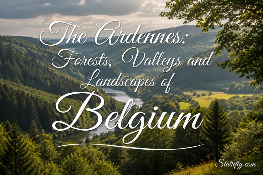
The Belgian Ardennes form the wooded high country of southern and eastern Wallonia, where broad plateaus are cut by winding rivers, steep-sided valleys and long forested slopes. The region is not a chain of sharp alpine peaks. Its character comes instead from elevation, deeply carved terrain and the contrast between enclosed woodland and open upland country. Rivers such as the Ourthe, Semois, Lesse and Amblève have shaped some of Belgium’s most recognizable inland landscapes.
The scenery changes over surprisingly short distances. A road or trail may cross a quiet agricultural plateau, enter dense woodland, descend sharply toward a river and then climb again to another open ridge. Farther east, the land rises toward the High Fens, where peatlands and open heath replace much of the familiar wooded scenery.
| Landscape Feature | Examples In Belgium | Typical Character |
|---|---|---|
| High plateaus | Plateau des Tailles, central Ardennes, High Fens | Open uplands, pasture, forest and cooler conditions |
| Forested valleys | Ourthe, Amblève, Semois and Lesse valleys | Steep slopes, river bends, woodland and rocky outcrops |
| Large forests | Forêt d’Anlier and forests around Saint-Hubert, Bouillon and Houffalize | Broadleaf and conifer stands divided by streams and clearings |
| Peatland uplands | High Fens | Open heath, bogs, wet ground and sparse woodland |
| Incised river landscapes | Semois near Bouillon, Ourthe near La Roche-en-Ardenne | Tight meanders, ridges, cliffs and wooded valley walls |
Where The Ardennes Sit In Belgium
The Ardennes are a natural region rather than a Belgian administrative division. Within Belgium, they occupy much of the higher ground in southern and eastern Wallonia. Their landscapes are especially prominent in Luxembourg Province and extend into parts of Namur and Liège provinces.
The wider Ardennes massif does not stop at Belgium’s borders. Related terrain continues into Luxembourg, France and Germany. On the Belgian side, though, the word Ardennes usually evokes the high plateaus, forests and enclosed valleys south of the Fagne-Famenne depression and across the elevated east of Wallonia.
There is no single edge where every visual feature suddenly changes. Geography is more gradual than that. Lower ridges and limestone country appear along the northern margin, while the terrain becomes higher and generally more upland toward the northeast.
A Plateau Cut By Deep Valleys
Looking at a relief map helps explain the Ardennes immediately. Much of the region is an elevated plateau, but rivers have cut deeply into it. The result is a landscape that often feels mountainous from within the valleys even though broad, relatively level surfaces remain above them.
The general rise of the terrain can be followed from southwest to northeast. La Croix Scaille reaches about 505 metres, the Recogne plateau rises to about 569 metres and Baraque de Fraiture reaches 652 metres. Farther northeast, the High Fens contain Belgium’s highest ground, including Signal de Botrange at 694 metres.
These figures may appear modest beside Europe’s major mountain ranges, yet elevation is only part of the story. River erosion creates large differences in height between valley floors and nearby ridges. Seen from below, a wooded slope rising abruptly from a narrow river can feel much higher than its absolute elevation suggests.
Why The Valleys Feel So Steep
The main plateau surfaces are repeatedly broken by streams and rivers flowing toward larger drainage systems. Over long periods, running water has cut into resistant bedrock and produced narrow valleys, entrenched meanders and steep wooded sides. Flat ground is limited in many valley sections, so roads, villages and fields often follow river terraces, gentler slopes or higher plateau surfaces.
This relationship between plateau and valley is one of the easiest ways to recognize the Ardennes. Above: broad land and long horizons. Below: water, shade, rock and enclosed forest.
Forests That Define The Region
Forest is one of the strongest visual elements of the Belgian Ardennes. Large wooded areas cover ridges and valley slopes, while smaller forests form a patchwork with pasture and farmland on the plateaus. The woods are not all the same. Deciduous stands, mixed woodland and conifer plantations can occur within the same wider landscape.
Oak and beech are prominent broadleaf trees in Wallonia’s forests, while spruce has long been an important conifer. Their forms create very different spaces. Mature deciduous woodland can have a relatively open floor beneath a high canopy; dense conifer stands may appear darker and more uniform. Mixed forests soften the boundary between the two.
Topography also changes the forest. Valley bottoms are wetter, steep slopes drain quickly, and exposed uplands experience cooler and windier conditions. Small streams, rocky ground, clearings and patches of wet vegetation interrupt the tree cover. For that reason, an Ardennes forest is rarely just an unbroken wall of trees.
The Forêt d’Anlier
In southeastern Belgium, the Forêt d’Anlier forms one of the best-known large woodland landscapes. It lies within the Haute-Sûre Forêt d’Anlier Natural Park, where forest, river valleys and the agricultural plateau around Libramont and Bastogne meet.
The contrast is particularly useful for understanding the Ardennes as a whole. Large forests matter, but so do the openings between them. Fields, pasture, villages and wooded ridges form a shifting mosaic rather than a single continuous forest ecosystem.
The Ourthe And Its Twin Headwaters
The Ourthe is closely tied to the image of the central Belgian Ardennes. It begins as two main branches, the Eastern Ourthe and Western Ourthe, before the waters unite and continue through increasingly enclosed terrain.
Near Houffalize and La Roche-en-Ardenne, the river and its tributaries create a classic Ardennes landscape: tight bends, forested slopes, rocky ridges and narrow valley floors. The surrounding plateau may lie only a short horizontal distance away, yet the climb from river level can be abrupt.
The Plateau des Tailles rises north of parts of this river system. Above 600 metres in places, it includes wet upland environments, streams and peat-forming ground. The contrast between these elevated source areas and the incised valleys downstream shows how closely water and relief are connected.
The Semois And The Southern Ardennes
Few rivers display the structure of the southern Ardennes as clearly as the Semois. Its course develops broad loops and tightly curved meanders through wooded terrain, especially around Bouillon, Rochehaut, Frahan and Vresse-sur-Semois.
Some bends almost fold back on themselves. Ridges remain between neighbouring parts of the river, creating distinctive promontories and viewpoints. The Tombeau du Géant near Botassart is a well-known example of this relationship between a deeply incised meander and the high ground enclosed by it.
Woodland dominates many of the slopes, while settlements occupy pockets of flatter land along the water or on nearby terraces. The pattern makes the Semois valley feel enclosed from river level but broad and layered when viewed from above.
The Lesse, Lomme And Houille Landscapes
The western and southwestern Ardennes are also shaped by the Lesse, Lomme and Houille. These rivers drain wooded uplands before continuing toward lower country. Their upper valleys help form the transition between central Ardennes plateaus and the more varied landscapes near the region’s northern edge.
The Lesse is especially interesting because its landscape changes downstream. In its Ardennes sections, the river runs through wooded and relatively enclosed country. Farther north, it enters limestone terrain associated with the Calestienne, where caves, cliffs and underground drainage add a different geological character.
That transition is a reminder that the Ardennes do not exist in isolation. Their edges meet neighbouring landscape regions, and rivers often reveal those changes more clearly than roads or administrative boundaries do.
The Amblève And The Eastern Valleys
Eastern Wallonia contains another dense network of wooded valleys. The Amblève and its tributaries cross terrain marked by forests, steep slopes and resistant rock. Around Stoumont and nearby uplands, river valleys sit below long wooded ridges and high plateaus.
The landscape becomes particularly rocky in places. At the Fonds de Quarreux, resistant quartzite blocks lie in and beside the Amblève, giving the river a rougher appearance than the quieter meandering sections found elsewhere in the Ardennes.
Farther east, the Our and upper Vesdre systems belong to a wetter highland setting influenced by the High Fens and Eifel. Here, streams, reservoirs, forests and wet uplands create another version of Ardennes scenery.
The High Fens And Belgium’s Highest Ground
The High Fens introduce a landscape that can surprise visitors expecting continuous forest. Large parts are open. Peatlands, wet heath, grasses and low vegetation spread across high, exposed ground, while forest surrounds or divides many of these open areas.
This is the highest part of Belgium. Signal de Botrange reaches 694 metres, and nearby Baraque Michel stands at roughly 675 metres. Cooler temperatures, abundant moisture and poorly drained soils have encouraged the development of bog and heath environments that differ sharply from the enclosed valleys below.
Water begins its journey here in countless small forms: wet hollows, peat-rich ground, springs and streams. Those small flows eventually feed larger rivers. The high plateau is therefore not simply an elevated viewpoint; it is part of the hydrological structure of eastern Belgium.
The Geology Beneath The Landscape
The shape of the Ardennes makes more sense when its bedrock is considered. Much of the region belongs to an old geological massif formed largely from shale, slate-like phyllite, sandstone and quartzite. Many rocks exposed in the southern Ardennes date from the Paleozoic era and were folded long before the modern valleys developed.
These are old rocks beneath a landscape whose present surface has been reshaped repeatedly by erosion. Rivers exploited weaker zones while harder beds resisted erosion, helping create ridges, rocky slopes and narrow passages.
Local stone also influences the appearance of traditional settlements. Darker stone and slate-like materials visually connect many villages with the ground around them. The relationship is easy to miss until a stone wall, exposed rock face and forested slope appear within the same view.
Villages, Fields And Forest Edges
The Ardennes are not an empty wilderness. Villages, pasture, farmland and woodland have shared the plateau for generations. Many settlements occupy relatively open ground, while large forests begin beyond the fields or descend over nearby slopes.
This produces a recurring visual sequence: village, pasture, forest edge, ridge and valley. Agricultural land tends to be more visible on gentler plateau surfaces, while steep ground remains more heavily wooded. In some places, hedges and lines of trees further divide the open country.
The pattern also creates very different views depending on elevation. From within a settlement, woodland may seem to form a close boundary. From higher ground, the same forest becomes one element in a larger patchwork stretching across successive ridges.
Natural Parks Across The Ardennes
Several Walloon natural parks protect and manage landscapes within the Belgian Ardennes. A natural park is a lived-in rural territory, so its boundaries can include villages, farmland, working forests and natural habitats rather than only strictly protected land.
| Natural Park | Area | Landscape Character |
|---|---|---|
| Ardenne Méridionale | 945 km² | Semois, Lesse and Houille valleys, forests, plateaus and southern Ardennes scenery |
| Haute-Sûre Forêt d’Anlier | 833 km² | Upper Sûre basin, Forêt d’Anlier, agricultural plateaus and wooded country |
| Deux Ourthes | 760 km² | Eastern and Western Ourthe, steep valleys, forest and Plateau des Tailles |
| Hautes Fagnes-Eifel | 720 km² | High Fens, peatlands, upland forest, rivers and eastern highlands |
| Sources | 148 km² | Forests, springs, wet habitats and the Amblève landscape around Spa and Stoumont |
These parks show how varied the term Ardennes landscape can be. One contains sweeping peatland. Another centres on two branches of a river. Elsewhere, broadleaf forest, farmland or deeply incised southern valleys dominate the scene.
River And Forest Restoration Today
Landscape conservation in the Ardennes also extends beyond park boundaries. The ongoing LIFE Vallées ardennaises project, scheduled from 2020 to 2028, works across the valleys of the Ourthe, Amblève, Vesdre and Our in northern and eastern Ardennes.
Its work covers river channels, floodplain habitats and wooded valley slopes. The current project area extends across about 25,966 hectares, 36 Natura 2000 sites and 33 municipalities. The approach reflects an important feature of Ardennes geography: rivers, valley forests and upland catchments function as connected landscapes rather than isolated pieces.
How The Landscape Changes With The Seasons
Seasonal change is unusually visible in a region where forest occupies so much of the view. In spring, deciduous woodland develops a fresh canopy while streams still carry water from the wetter months. Meadows and forest edges become brighter, but shaded valleys can remain cool.
Summer strengthens the contrast between open plateaus and enclosed woods. Broadleaf canopies become dense, and narrow valleys may feel much darker than neighbouring ridges. The High Fens remain visually different, with broad open horizons rather than a continuous tree canopy.
Autumn changes the structure again. Oak, beech and other deciduous trees introduce warm leaf tones among darker conifers. Because the terrain folds repeatedly into valleys and ridges, the colour often appears in layers rather than across one flat forest surface.
Winter exposes the land beneath the trees. Bare deciduous branches reveal slopes, rock and river bends that dense foliage can partly hide during summer. On the highest plateaus, frost, fog and occasional snow can give the eastern Ardennes a distinctly upland appearance.
Landscape Differences From West To East
- Western and southwestern Ardennes: wooded plateaus crossed by rivers such as the Lesse and Houille, with transitions toward the Fagne-Famenne and Calestienne.
- Southern Ardennes: the Semois and its pronounced meanders create some of the region’s strongest contrasts between river, ridge and forest.
- Central Ardennes: agricultural and wooded plateau surfaces are divided by enclosed valleys, including the Ourthe system.
- Northeastern Ardennes: higher elevations, wetter conditions, peatlands and the High Fens become more prominent.
- Eastern Ardennes and Eifel border country: forested hills, river valleys, reservoirs and highland landscapes continue toward Germany and Luxembourg.
No single landscape represents the whole Belgian Ardennes. Its identity comes from the repetition of several features in different combinations: old rock, high ground, forest, flowing water and deeply cut valleys. Move from the Semois to the Ourthe or from the central plateau toward the High Fens, and the balance changes. The underlying geography, though, remains clearly related.
That is why the Ardennes can feel both broad and enclosed. From a plateau, the horizon may stretch across fields and distant forests. A few kilometres away, the same land can close tightly around a river beneath steep wooded slopes. The shift happens again and again across southern and eastern Belgium.