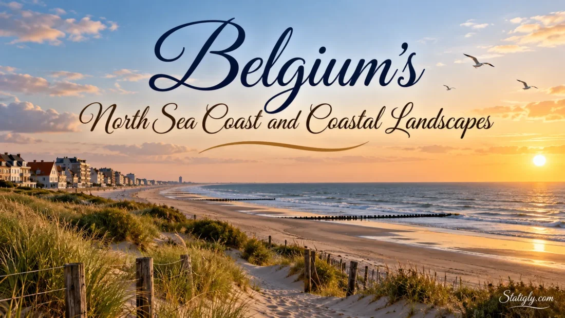
Belgium meets the North Sea along a coastline of about 67 kilometres, stretching from the French border near De Panne to the Dutch border beyond Knokke-Heist. Short on a map, this coast holds an unusual amount of variety. Wide sandy beaches give way to dune ridges, tidal creeks, polders, estuaries, seaside promenades and compact coastal towns. Travel only a few kilometres and the view can change completely. That rapid shift is one of the defining features of Belgium’s coastal landscape.
The entire Belgian coast lies in West Flanders. The North Sea sets the rhythm here. Tides move the shoreline back and forth each day, wind reshapes exposed sand, and salt water influences plant life around estuaries and marshes. Behind the beach, natural dunes and flat reclaimed lowlands add another layer to the scenery.
| Coastal Landscape | Where It Is Especially Visible | What Defines It |
|---|---|---|
| Sandy beach and intertidal shore | Along almost the entire Belgian coast | Broad sand, tidal wet-sand zones and an open North Sea horizon |
| Dune systems | De Panne, Koksijde, Bredene, De Haan and parts of the eastern coast | Wind-shaped sand ridges, dune grassland, shrubs and sheltered dune hollows |
| Yser estuary | Nieuwpoort | River mouth, tidal flats, salt-influenced vegetation and open water |
| Polders | Behind much of the coastal strip | Low, flat land crossed by drainage channels, roads and fields |
| Urban seafront | Ostend, Middelkerke, Blankenberge and Knokke-Heist | Promenades, sea walls, buildings, harbours and beach access points |
| Zwin tidal landscape | Eastern edge of Knokke-Heist | Mudflats, salt marshes, tidal creeks, dunes and polders |
How Belgium’s North Sea Coast Is Shaped
The Belgian coast is part of the southern North Sea’s sandy coastal plain. There are few cliffs or rocky headlands. Sand dominates instead. Waves, currents, tides and wind continually move sediment along the shore, while dunes form where dry beach sand is carried inland and trapped by vegetation.
This produces a landscape that is more layered than it first appears. Walking inland from the water can take a visitor across several different zones: wet tidal sand, dry upper beach, young dunes, older vegetated dunes and then the flatter land behind them. In developed areas, a promenade or sea wall interrupts that natural sequence. Elsewhere, the transition remains far easier to see.
The coast is therefore not simply a line between land and sea. It is a moving strip of sand, water and vegetation.
Broad Sandy Beaches and the Intertidal Zone
Sand beaches run along nearly the whole Belgian North Sea coast. At low tide, the exposed beach can feel remarkably broad, with darker wet sand extending toward the retreating waterline. As the tide rises, much of that surface disappears beneath the sea again.
The part of the shore that alternates between exposure and flooding is the intertidal zone. Look closely and its surface is rarely uniform. Shallow channels, small pools, shell fragments, wave marks and ripples in the sand record the most recent movement of the water.
Because the Belgian shoreline is relatively straight, long views are common. On clear days, the beach may seem to run almost without interruption toward the horizon. Yet the character changes from place to place. Some stretches face busy promenades and seaside buildings. Others sit below dune ridges covered with grass.
Dunes: The Coast’s Natural Relief
Belgium is often associated with flat landscapes, so the coast brings a surprise: sand dunes create some of its most noticeable natural relief. They rise behind sections of beach and form a protective, living boundary between the North Sea and the land farther inland.
Dunes do not all look alike. The youngest ridges near the beach may contain open sand and tough grasses able to cope with wind, salt spray and shifting ground. Farther inland, older dunes can support denser grassland, shrubs and patches of woodland. Lower hollows between dunes may become damp enough to support a different group of plants again.
De Panne and the Western Dunes
The far west around De Panne contains some of the coast’s broadest surviving dune landscapes. The De Westhoek area forms part of a much larger network of dunes and woodland around De Panne, close to the French border.
Here, the terrain rolls rather than remaining flat. Paths pass through open dune grassland, sandy slopes, sheltered hollows and areas where vegetation has stabilised older sand. De Westhoek itself covers about 361 hectares within the wider protected dune landscape of De Panne.
Wind remains part of the story. Some conservation work in the western dunes aims to keep areas of sand mobile instead of allowing every open surface to become permanently covered by vegetation. A healthy dune system needs both stability and movement.
Koksijde and Oostduinkerke
East of De Panne, the coast around Koksijde and Oostduinkerke continues the pattern of beach, dunes and low inland ground. Dune areas such as the Doornpanne and the Ter Yde landscape show that coastal dunes are not merely narrow sandy ridges immediately behind the beach. They can form wider systems with dry grassland, dune hollows and older inland dunes.
This western section is one of the easiest places to understand how the natural Belgian coast fits together. Sea first, then beach, then dunes, then flatter land behind them. Simple on paper. Much more textured on the ground.
Polders Behind the Dune Belt
Walk or cycle away from the sea and the scenery can suddenly flatten. These low inland areas are part of the coastal polder landscape, a broad zone of low-lying land shaped by centuries of water management.
Polders often have a very different visual character from the beachfront. The horizon opens. Fields are divided by drainage channels and narrow waterways. Roads frequently run straight across the plain, while farm buildings, rows of trees and village towers become visible from a long distance.
The contrast with the dunes can be striking. One moment the view is enclosed by sandy ridges and grass. A short distance farther inland, the land seems to unfold into a wide horizontal plane.
These polders are an important part of understanding Belgium’s coast because the coastal landscape does not stop at the beach. The sea has influenced the shape and use of land well beyond the present waterline.
The Yser Mouth at Nieuwpoort
Nieuwpoort introduces another coastal form: an estuary. The Yser River reaches the North Sea here, creating a meeting place between river water, tidal seawater and coastal sediment.
The landscape around the river mouth differs from the long open beach found nearby. Tidal flats, salt-influenced vegetation, channels and sheltered waters create more varied edges. The IJzermonding nature area preserves intertidal habitats beside the estuary, where water levels and exposed ground change with the tide.
Nieuwpoort also shows how natural and human-shaped coastal features can sit close together. The estuary, harbour approaches, marina areas, beaches and dunes all occupy the same relatively compact stretch of coast.
Seaside Towns and Built Coastal Landscapes
Nature is only half of the visual story. Belgium’s North Sea shoreline also has a strongly recognisable seaside town landscape. Promenades run beside beaches, residential buildings face the water, tram tracks pass through coastal communities and harbour structures break the otherwise straight shoreline.
These built sections do not all feel the same. Ostend has a broad urban waterfront and a strong maritime character. Blankenberge combines a developed seafront with a pier extending over the beach and sea. De Haan offers a softer transition between town, dunes and greenery. Knokke-Heist brings together long beach frontage, residential areas and natural landscapes toward the Zwin.
Sea Walls and Promenades
Many Belgian resorts have a paved promenade or sea wall directly behind the beach. This creates a clear boundary: open sand and sea on one side, shops, homes and streets on the other.
Such promenades also offer unusually long views along the coastline. Because the terrain remains low, even modest changes in elevation can open a wide panorama over the beach and North Sea.
Harbours and Maritime Edges
Harbour landscapes add another shape to the coast. Ostend, Nieuwpoort and Zeebrugge each interrupt the continuous beach line with channels, breakwaters, basins or maritime infrastructure. The geometry changes at once: instead of a single straight shoreline, water enters between constructed edges.
Zeebrugge is especially different from nearby resort beaches because its large port creates a broad maritime landscape. A relatively short journey from there toward Knokke-Heist leads back to beaches, dunes and, eventually, tidal nature at the Zwin.
The Zwin and Belgium’s Tidal Marsh Landscape
At the eastern end of Belgium’s coast lies one of its most distinctive natural areas: the Zwin. This tidal landscape reaches the Belgian-Dutch border and contains mudflats, salt marshes, creeks, dunes and nearby polders.
The sea still enters the Zwin through a tidal channel. Water flows into creeks and low ground as the tide rises, then retreats again. Mud that appears firm and empty from a distance can support dense marine life beneath the surface, helping make the area attractive to feeding waterbirds and waders.
The Zwin Plain was enlarged in 2019, adding about 120 hectares and bringing the tidal plain to roughly 333 hectares. The expansion gave seawater more room to enter and leave the area and created additional tidal habitat.
Salt Marsh Plants
Ordinary garden plants would struggle with regular saltwater flooding. Salt-marsh species have adapted to it. The Zwin supports plants such as sea lavender, glasswort, sea purslane and sea aster, each occupying slightly different positions according to how often seawater reaches the ground.
Sea lavender and other salt-tolerant plants are particularly noticeable during the warmer part of the year. The park identifies July through September as a useful period for seeing many of these plants in flower.
How the Coast Changes from West to East
A west-to-east journey reveals the structure of the Belgian coast better than viewing any single resort in isolation.
- De Panne: broad beach and extensive western dune landscapes near the French border.
- Koksijde: beach backed by several major dune areas, with Oostduinkerke forming part of the same municipality.
- Nieuwpoort: dunes and beach meet the Yser estuary, harbour and marina landscape.
- Middelkerke: a long open beachfront with developed seaside sections and nearby dune areas.
- Ostend: the coast becomes distinctly urban, with a major seafront, harbour and maritime setting.
- Bredene: dunes play a more visible role between the beach and settlement.
- De Haan: beach, dunes, greener residential streets and villa areas create a less continuous high-rise frontage.
- Blankenberge: an urban resort landscape with a wide beach and prominent pier.
- Zeebrugge: the coastline is strongly shaped by port infrastructure alongside beach areas.
- Knokke-Heist: long beaches lead eastward toward dunes, polders and the tidal Zwin landscape.
No mountain ranges separate these places. No long distances either. The transitions happen quickly, which is precisely why the coastline is so useful for seeing several types of North Sea landscape within a compact area.
Wildlife and Plant Life Along the Shore
The coast supports wildlife because several habitats sit side by side. Beach, dunes, damp dune hollows, salt marsh, tidal mud, open water and polders each offer different conditions.
Dune plants must tolerate wind, moving sand and salt carried through the air. Marram grass is one of the most recognisable examples. Its roots and underground stems help trap sand, allowing dune ridges to grow around it.
Tidal areas attract many birds because retreating water exposes feeding grounds. The Zwin is especially well known for bird observation, while the Yser estuary provides another mix of tidal and open-water habitat. What appears to be bare mud to a walker can be a feeding area rich in small organisms for birds.
The scenery changes with the vegetation too. Open pale sand dominates young dunes. Older dunes can turn green with grasses and low plants, while sheltered sections may carry dense shrubs. In the polders, the landscape becomes broader, lower and more agricultural.
How Tides Change What You See
A visit to the same Belgian beach at different stages of the tide can feel like visiting two different places. At low tide, large areas of wet sand appear and the sea may seem surprisingly distant from the promenade. At higher water, the active shoreline moves much closer to the upper beach.
The effect becomes even clearer in a tidal creek or salt marsh. At the Zwin, seawater enters channels with the rising tide and drains away again as the tide falls. Mudflats that are exposed at one moment may later sit under water.
For anyone interested in landscapes rather than only beaches, watching the tide is part of understanding the coast. It reveals that the boundary between land and sea is temporary, not fixed.
Walking, Cycling and the Coastal Tram
Belgium’s coastline is unusually easy to explore in sections. Walking routes cross dune reserves, promenades and tidal landscapes, while the flat terrain behind the coast suits cycling particularly well.
The Coastal Tram adds another option. It runs from De Panne in the west to Knokke in the east and stops throughout the coastal strip. That makes one-way walks practical: a visitor can walk along a beach, through dunes or between neighbouring resorts and return by tram rather than following the same route back.
The tram also makes landscape changes easy to notice. From west to east, views alternate between dunes, seaside streets, open beach approaches, harbour zones and town centres. Step off a few stops later and the setting may feel different again.
What the Coast Looks Like Through the Year
Spring
Longer daylight brings more visible growth to dune grasslands and sheltered natural areas. It is a pleasant period for observing the contrast between pale sand, fresh vegetation and open sea without relying on summer beach conditions.
Summer
Beach life becomes a larger part of the visual landscape, especially around the major resorts. Inland from the busiest seafronts, dune paths and nature areas reveal a quieter side of the same coastline. At the Zwin, summer also brings the flowering season of several salt-marsh plants.
Autumn
Changing vegetation and bird movement can alter the character of nature reserves and tidal areas. Cooler days also make longer walks across dunes, beaches and polders appealing for visitors interested primarily in scenery.
Winter
The landscape becomes visually simpler. Bare stretches of beach, pale dune grass and broad skies can dominate the view. With fewer seasonal beach structures in sight, the underlying shape of the coastline often becomes easier to read.
A Coastal Route Focused on Landscapes
A landscape-focused journey can begin at De Panne, where the western dunes provide a natural starting point. Moving east through Koksijde shows more of the dune belt before the Yser estuary changes the scenery at Nieuwpoort.
Continue through Middelkerke toward Ostend to see the coast become more urban and maritime. Beyond Ostend, Bredene and De Haan bring dunes and greenery back into clearer view. Blankenberge shifts the scene toward an urban resort again, followed by the maritime scale of Zeebrugge.
The final stretch through Knokke-Heist leads toward the Zwin, where mudflats, salt marshes, tidal creeks, dunes and polders meet near the Dutch border. In roughly 67 kilometres, the coast has moved from western dune country through estuary, resort, harbour and beach landscapes to a tidal nature area. Few stretches of coastline pack those changes into such a short distance.