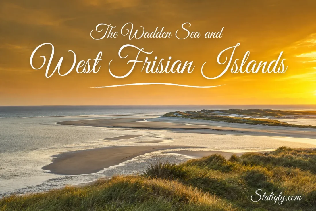
Between the Dutch mainland and the North Sea lies a coast that redraws itself twice each day. The Wadden Sea fills, drains, and fills again, while the West Frisian Islands stand along its outer edge as a loose barrier of sand, dunes, beaches, and salt marshes. Water rules the rhythm here. At low tide, broad flats appear between shining channels; at high tide, much of that open ground slips beneath the water. The five main Dutch islands—Texel, Vlieland, Terschelling, Ameland, and Schiermonnikoog—offer the clearest way to see this changing landscape from land.
Where The Wadden Sea Meets The West Frisian Islands
The Wadden Sea runs along the coasts of the Netherlands, Germany, and Denmark. It is not an open sea in the usual sense. A chain of barrier islands shelters its shallow waters from the North Sea, creating a wide tidal zone filled with mudflats, sandbanks, channels, salt marshes, and sheltered coastal waters.
The West Frisian Islands form the Dutch part of that barrier chain. They curve from Texel in the west toward the German border in the east. The familiar group consists of five inhabited islands, though smaller uninhabited islets and sandbanks also belong to the same coastal system. Their outlines are not fixed. Wind carries sand, currents cut new channels, and tides reshape island edges year after year.
| Island | Position and Character | Mainland Ferry Port | Useful Detail |
|---|---|---|---|
| Texel | Westernmost and largest of the five; varied dunes, polders, woodland, and villages | Den Helder | Visitors can take cars, bicycles, or travel on foot |
| Vlieland | Long, narrow, and dune-rich; known for one main village and the broad Vliehors sand plain | Harlingen | Visitor car access is restricted |
| Terschelling | A long island with villages, dunes, beaches, and the eastern Boschplaat reserve | Harlingen | Cars are permitted, though a bicycle suits many routes |
| Ameland | Four villages set among dunes, polders, beach, and salt-marsh scenery | Holwert | Cars are permitted; buses and bicycles serve the island |
| Schiermonnikoog | A highly natural island shaped by dunes, marshes, beaches, and shifting sand | Lauwersoog | Visitor car access is restricted; most of the island is a national park |
The table shows the practical pattern, but each island feels different on the ground. Texel has more room and more varied settlements. Vlieland and Schiermonnikoog place nature close to the village. Terschelling stretches far from west to east. Ameland balances village life with open coastal land. Shared by all five are broad skies, steady wind, marked cycling routes, and a shore that never looks quite the same for long.
Why The Wadden Sea Changes By The Hour
High Tide and Low Tide
Sea water enters the Wadden Sea through gaps between the islands as the tide rises. It follows deep channels first, then spreads across lower sand and mud. When the tide turns, the water flows back toward the North Sea. Large areas emerge again. This repeated movement brings oxygen and nutrients across the flats and connects habitats that may appear separate on a map.
A visitor standing beside a tidal channel may see water moving with the speed and direction of a river. A few hours later, the same view can become an open plain crossed by narrow streams. The landscape keeps time with water.
Sand, Mud, and Moving Channels
Different parts of the Wadden Sea collect different sediments. Faster water tends to leave coarser sand, while calmer areas allow fine silt to settle. That is why one tidal flat can feel firm and rippled, while another remains soft and muddy. Channels shift as currents find new paths. Sandbanks grow, narrow, split, or join nearby land.
The islands move more slowly, yet the same forces shape them. Beaches may gain sand in one place and lose it in another. New dunes begin where windblown grains gather around plants. On exposed island ends, wide sandy plains show the process with unusual clarity. Fixed on a road map, the islands may look still. They are not.
The Five Main Dutch Wadden Islands
Texel: The Largest and Most Varied Island
Texel belongs to the province of North Holland and has the shortest regular sea crossing of the five islands. Its size allows several landscapes to sit side by side: North Sea beaches, dune valleys, woodland, grassland, polders, wet areas, and Wadden Sea shore. The dunes along the western side form part of Dunes of Texel National Park.
Texel works well for travelers who want nature without giving up a broad choice of routes and villages. Cyclists can link inland lanes with dune paths, while walkers can focus on the beach, forest, or bird-rich wetland areas. The island’s western coast faces the open North Sea; its eastern shore looks across the calmer Wadden Sea. That contrast makes the island’s geography easy to read.
Vlieland: Dunes, Forest, and The Vliehors
Vlieland is narrow, lightly settled, and largely covered by natural land. Oost-Vlieland is its only village. From there, paths lead into dunes, planted forest, beach, and open coastal scenery. Since visitor cars are restricted, bicycles, walking, buses, and local transport set the pace.
The western part of the island opens into the Vliehors, an immense sand plain exposed to wind and sea. It can seem almost empty, yet it remains part of an active coastal system. Access conditions may change with tides, weather, nature protection, and local use, so marked routes and current local advice matter.
Terschelling: A Long Island With Many Landscapes
Terschelling stretches for roughly 30 kilometers from west to east. Villages and farmland occupy part of the center, with dunes and North Sea beach to the north and Wadden Sea land to the south. Its length rewards unhurried travel. A bicycle ride can move from a lively harbor setting into open dunes and quiet eastern scenery.
At the eastern end lies De Boschplaat, a broad protected area of dunes, beach, sand flats, and salt marsh. Birds gather here in large numbers during migration and breeding seasons. Some zones may close temporarily to give nesting birds room, and the marked boundaries deserve close attention. The island also has small wet dune valleys, including places where cranberries grow.
Ameland: Four Villages Between Two Shores
Ameland combines four villages—Hollum, Ballum, Nes, and Buren—with a clear sequence of beach, dunes, cultivated land, and tidal shore. The compact pattern makes the island easy to explore by bicycle. A route can pass historic village streets, open fields, dune paths, and viewpoints over the Wadden Sea within one day.
Nature becomes more expansive toward the island’s eastern side, where salt marshes and sandy coastal land meet the tides. On the west, the lighthouse near Hollum serves as a familiar landmark. Ameland suits visitors who want a recognizable village base and direct access to several coastal habitats.
Schiermonnikoog: One Village Inside A Moving Landscape
Schiermonnikoog has one main village and restricted visitor car access. Most of the island belongs to Schiermonnikoog National Park, established in 1989. Dunes, beach, forest, freshwater areas, salt marsh, and tidal flats sit within a relatively small space, making walking and cycling especially rewarding.
The eastern side gives wind, sand, and water more freedom to shape the shore. This is where the island’s mobile character becomes visible: new sand settles, creeks form through marshland, and the boundary between land and sea stays fluid. More than 300 bird species may be recorded on or around the island over the course of a year, a reflection of its varied habitats and position on a major migration route.
Habitats Between Land and Sea
Tidal Flats and Channels
At low tide, exposed flats become feeding grounds. Worms, shellfish, small crustaceans, and other organisms live within or on the sediment. Shorebirds use different bill shapes and feeding methods to reach them. Some search the surface; others probe into soft mud or shallow water.
Channels remain underwater longer than the flats around them. Fish and other marine life move through these routes with the tide. Their depth and current can be hard to judge from shore, which is one reason independent walks far onto the seabed are not suitable.
Salt Marshes and Dune Valleys
Salt marshes develop where plants slow the water and trap sediment on higher parts of the tidal shore. They flood less often than bare mudflats, but salt water still reaches them. Plant communities change with height, soil, and flooding frequency. Glasswort can grow low on the marsh, while grasses and flowering plants occupy higher ground.
Behind the beach, dunes create another set of habitats. The first low ridges catch blowing sand. Older dunes can support grassland, shrubs, and woodland. Rainwater gathers in hollows known as dune slacks, allowing moisture-loving plants to grow only a short distance from dry sand. Small changes in height make a large difference here.
Birds and Seals
The Wadden Sea sits on the East Atlantic Flyway, used by birds traveling between northern breeding areas and wintering grounds farther south. Around 10 to 12 million birds pass through the wider Wadden Sea in an average year, and as many as 6.1 million may be present at one time. For many species, the area acts like a vast dining room between long flights.
Harbor seals and gray seals also live in the region. At low tide, they may rest on remote sandbanks. Boat trips sometimes observe them from an appropriate distance. Rest matters, especially when young seals are present, so responsible operators avoid close approaches and sudden disturbance.
Why The Wadden Sea Has UNESCO World Heritage Status
The Wadden Sea entered the UNESCO World Heritage List in 2009, initially covering protected areas in the Netherlands and Germany. The listed property expanded in 2014 to include the Danish Wadden Sea and an additional German area. Today it covers more than 1.1 million hectares across the three countries and forms the world’s largest unbroken system of intertidal sand and mud flats.
Its value comes from active natural processes on a very large scale. Tides transport sediment. Barrier islands develop and move. Salt marshes form along sheltered edges. Food produced in the shallow system supports fish, seals, and immense numbers of birds. Few temperate coasts still contain such an extensive, connected intertidal landscape.
The World Heritage property is mainly about the natural Wadden Sea system. It does not mean that every village, road, farm, and beach on every island carries the same designation. Many island areas do have national or European protection as well, but those boundaries vary. Visitors should follow local signs rather than assume that access rules are identical across the archipelago.
Ways To Experience The Dutch Wadden Landscape
- Cycle across an island: Dedicated paths connect villages, dunes, woodland, and coastal viewpoints. Wind direction can make the return ride feel very different from the outward journey.
- Walk a marked nature route: Short loops through dunes or salt-marsh edges often reveal more detail than a long ride.
- Join a guided mudflat walk: Trained local guides plan around tides, channels, weather, and ground conditions. This is the proper way to walk far onto tidal flats.
- Watch birds around high tide: As water covers feeding flats, birds gather at higher resting places. Local bird hides and viewing points provide space without crowding them.
- Take a nature boat trip: A trip through channels helps explain the scale of the sea and may offer distant views of seals and sandbanks.
- Visit both shores: Compare the open North Sea beach with the sheltered Wadden Sea side. The difference explains the basic shape of every island.
A pair of binoculars often adds more to a Wadden visit than a packed schedule. So does waiting. Stay beside one creek through a turning tide, and a quiet patch of mud begins to show its life.
Choosing A Season For The Wadden Sea
Spring
Spring brings longer days, fresh dune growth, and active bird migration. Breeding season also begins. Some beach, dune, or marsh sections may have temporary access limits, which help ground-nesting birds raise their young.
Summer
Summer offers the longest daylight and the broadest range of visitor services. Beaches and main villages are busier, while early mornings remain well suited to cycling and wildlife watching. Ferry and accommodation reservations matter most during school holiday periods.
Autumn
Autumn is one of the strongest seasons for bird movement. Changing light, active weather, and large feeding flocks give the tidal landscape a clear sense of motion. Waterproof layers earn their place in the bag.
Winter
Winter brings wide views, short days, and a quieter rhythm. Some attractions and services operate on reduced schedules, so checking opening times prevents wasted journeys. Coastal wind can make the temperature feel lower than the forecast suggests.
Ferries, Bicycles, and Island Travel
Each inhabited West Frisian Island has a regular ferry link with the Dutch mainland. Texel connects with Den Helder; Vlieland and Terschelling with Harlingen; Ameland with Holwert; and Schiermonnikoog with Lauwersoog. Timetables vary by route and season, while weather or water conditions can affect individual sailings. The ferry operator’s current schedule should settle the day’s plan.
Cars can travel to Texel, Terschelling, and Ameland, subject to operator arrangements and local parking rules. Visitors generally cannot bring cars to Vlieland or Schiermonnikoog without specific permission. Both islands have buses, taxis, bicycle rental, and compact route networks. Even on islands where cars are allowed, a bicycle often provides the most direct connection with the landscape.
Planning An Island-Hopping Route
Direct boats between neighboring islands do exist on selected routes, yet many are seasonal, weather-dependent, or limited in frequency and bicycle space. They do not form a simple daily chain like the mainland ferries. A reliable island-hopping plan checks every crossing before booking accommodation. In many cases, returning to the mainland between islands gives more control over timing.
Reading The Landscape With Care
- Check tide times locally. High and low water occur at different times along the coast, so a tide table for one port may not match another location.
- Use a guide on open mudflats. Water can return through channels before nearby flats disappear. Soft ground and mist add further uncertainty.
- Keep to marked paths and open zones. Dune vegetation is easily damaged, and seasonal closures protect nesting or resting wildlife.
- Give animals space. Watch birds and seals from a distance. If animals become alert or move away, the distance is too small.
- Prepare for wind and quick weather changes. A light waterproof layer, sun protection, drinking water, and secure footwear cover most ordinary outings.
- Leave natural objects where they belong. Shell banks, plants, drift material, and living shore communities all play a part in the coastal habitat.
Common Questions About The Wadden Sea and West Frisian Islands
Are The Wadden Sea and West Frisian Islands The Same Place?
No. The Wadden Sea is the shallow tidal sea and wetland system along the Dutch, German, and Danish coasts. The West Frisian Islands are the Dutch barrier islands along its North Sea edge. They belong to the same natural system but describe different geographic features.
How Many West Frisian Islands Are There?
Five main inhabited islands appear on most travel maps: Texel, Vlieland, Terschelling, Ameland, and Schiermonnikoog. Several smaller uninhabited islands, islets, and sandbanks also lie within the Dutch chain. Because some sandy features change shape or join nearby land, a single count without a clear definition can mislead.
Which Island Is Easiest To Visit For One Day?
Texel is often the simplest day trip because the ferry from Den Helder is short and frequent. Ameland and Schiermonnikoog can also work well when ferry times match the day. Vlieland and Terschelling involve longer crossings from Harlingen, so an overnight stay allows more time away from the harbor.
Can Visitors Walk On The Wadden Sea Floor?
Yes, but an open mudflat excursion should be taken with a qualified local guide. A guided wadlopen trip uses detailed knowledge of tides, channels, weather, and safe routes. Walking on a firm beach at low tide is a different activity from crossing exposed flats away from shore.
Do The West Frisian Islands Move?
Their settlements and protected shorelines may appear stable, but the natural island edges keep changing. Currents move sand through tidal inlets, waves reshape beaches, and wind builds or erodes dunes. The greatest changes often occur on broad eastern and western island ends where sand has more room to shift.
Is West Friesland The Same As The West Frisian Islands?
No. West Friesland usually refers to a mainland region in the province of North Holland. The West Frisian Islands are the island chain north of the Dutch coast. The similar names come from geography and Frisian cultural history, but they point to different places on a modern map.
What Is The Most Respectful Way To Watch Wildlife?
Use marked viewpoints, keep dogs under the control required by local signs, and avoid approaching resting groups. Binoculars provide a close view without taking away an animal’s space. On the Wadden coast, distance is part of good observation.