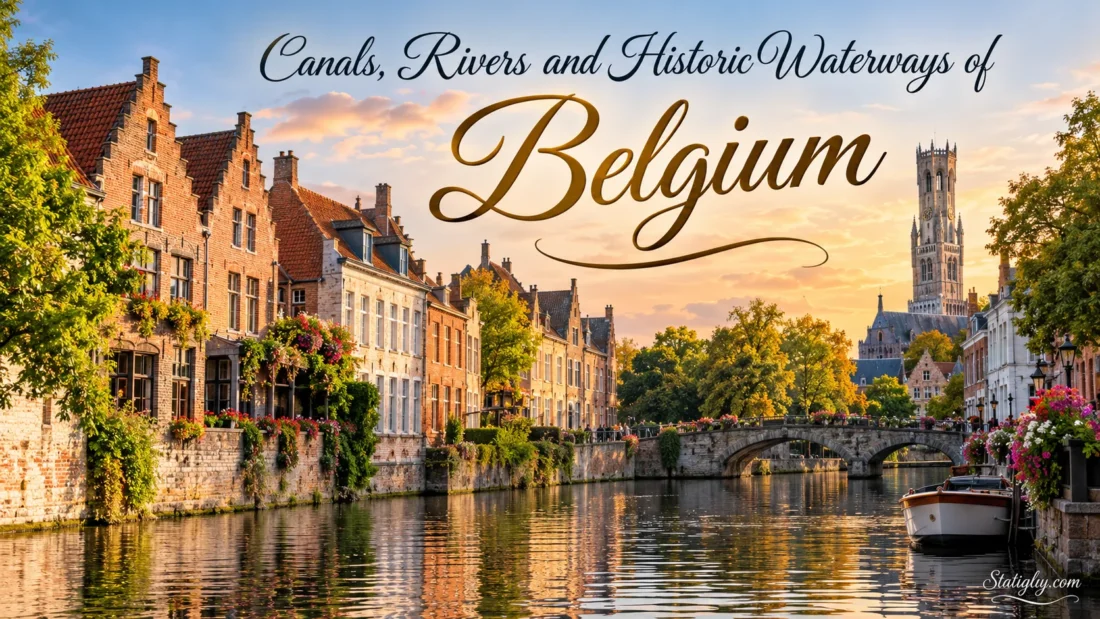
Belgium is crossed by a dense network of rivers, canals and historic urban waterways that link coastal ports, inland cities and neighboring countries. Some are natural rivers altered over centuries for navigation; others were dug to connect river basins or shorten trade routes. Together they explain why places such as Antwerp, Ghent, Bruges, Brussels, Liège, Namur and Charleroi developed so closely around water. The network is compact, yet remarkably varied: a visitor can see medieval city canals, broad working rivers, modern freight corridors and century-old hydraulic engineering within the same country.
Belgian waterway names can also look different from one map to another. The Scheldt is the Escaut in French, the Meuse is the Maas in Dutch, and the Leie is generally called the Lys in French and English-language material. Knowing these paired names makes the network much easier to follow.
| Waterway | Type | Main Belgian Places | What Makes It Notable |
|---|---|---|---|
| Scheldt / Escaut | River | Tournai, Ghent region, Antwerp | Major international navigation route leading toward the North Sea |
| Meuse / Maas | River | Dinant, Namur, Huy, Liège | Broad navigable river crossing much of eastern Wallonia |
| Sambre | River | Charleroi, Namur | Meets the Meuse at Namur and forms an important east-west route |
| Leie / Lys | River | Kortrijk, Deinze, Ghent | Historic navigation route with both working and scenic sections |
| Yser / IJzer | River | Diksmuide, Nieuwpoort | West Flanders river reaching the North Sea at Nieuwpoort |
| Albert Canal | Canal | Antwerp region, Hasselt area, Liège | Main canal connection between the Scheldt and Meuse systems |
| Brussels Canal Corridor | Canal system | Brussels | Connects the capital north toward the Scheldt and south toward Charleroi |
| Canal du Centre | Canal | La Louvière, Le Roeulx | Known for historic hydraulic lifts and the modern Strépy-Thieu boat lift |
The Rivers That Shape Belgium
The Scheldt: Belgium’s Northern Waterway
The Scheldt is one of the defining rivers of Belgium. It enters the country from France, passes through Wallonia near Tournai and continues into Flanders before flowing through Antwerp and onward toward the estuary in the Netherlands. This makes it part of an international river system rather than a waterway contained within Belgian borders.
Its Belgian course changes character along the way. Around Tournai it is the Upper Scheldt, a managed inland navigation route. Farther north, the river becomes connected with an intricate Flemish system of tributaries, canals and port waterways. By Antwerp, the Scheldt is broad enough to define the landscape of the city itself.
The river also connects naturally with other waterways. Ghent sits near the meeting point of the Scheldt and the Leie, while the Rupel links the Scheldt system with rivers such as the Dijle and Nete. Looking at Belgium’s waterways as isolated blue lines misses the point. They work as a network.
The Meuse: A River Through Southern Belgium
The Meuse follows one of Belgium’s most recognizable river landscapes. Entering from France, it reaches places such as Dinant, Namur, Huy and Liège before continuing toward the Netherlands. Rock faces, wooded slopes, towns, bridges and locks give different stretches of the river their own character.
At Namur, the Sambre joins the Meuse. This confluence is easy to understand on the ground: the historic city occupies the meeting point of two navigable river valleys. From there, the Meuse continues east toward Huy and Liège, where the waterway becomes closely tied to large-scale inland navigation.
The river remains both a transport corridor and a visible part of everyday urban scenery. In places such as Dinant, the town seems to stretch along the water because the valley itself leaves little room to do anything else.
The Sambre: From Charleroi to Namur
The Sambre enters Belgium from France and passes through the Charleroi area before flowing east to Namur. Locks regulate the navigable river, turning a naturally changing watercourse into a practical route for vessels.
Its meeting with the Meuse gives Belgium one of its clearest examples of river geography shaping a city. Viewed from Namur, the two valleys point in different directions: the Sambre toward the west and the Meuse toward both south and east. The result is a natural crossroads on water.
The Leie: A River Shared by Trade and Landscape
The Leie, or Lys, comes from northern France and reaches Belgium near the French-Flemish border. It continues through Kortrijk and the Flemish interior toward Ghent. Parts of the river have been adapted for modern navigation, while older bends and quieter stretches preserve a softer landscape.
Near Ghent, water becomes woven directly into the city. The Leie passes famous quays such as the Graslei and Korenlei before joining the Scheldt system. Outside the urban center, stretches of the river pass meadows, villages and old river bends.
Navigation improvements continue to change selected parts of the Leie. The modern route needs enough width and depth for larger inland vessels, while projects along the river also retain or create naturalized banks where conditions allow.
The Yser and Other Smaller Rivers
Not every Belgian river belongs to the Scheldt or Meuse systems. The Yser crosses West Flanders and reaches the North Sea at Nieuwpoort. Its lowland setting feels quite different from the enclosed Meuse Valley.
Other rivers add further branches to the inland network. The Dender passes Aalst before joining the Scheldt at Dendermonde, while the Dijle and Nete form part of the connected waterways of central and northern Belgium. These rivers are smaller on a national map, but locally they shape town centers, paths, bridges and waterside landscapes.
Canals That Connect Belgium’s River Basins
Belgium’s canals often make sense once the river basins are understood. Engineers created artificial links where natural rivers did not provide a direct route. Locks, pumping stations, boat lifts and inclined planes then solved the problem of changing ground levels. A canal may look calm from its towpath, yet the engineering behind that level strip of water can be surprisingly elaborate.
The Albert Canal
The Albert Canal is a main freight artery between the Antwerp and Liège regions. It connects the Scheldt side of the country with the Meuse at Liège, giving inland vessels a direct east-west route across northern Belgium.
Unlike the narrow waterways of old city centers, the Albert Canal is built around large-scale navigation. Bridges, locks, quays and industrial waterside sites reveal its purpose immediately. Modernization has included raising bridges and widening selected sections so that larger container loads can move along the route more easily.
For anyone trying to understand Belgium’s modern canal network, this is one of the best places to see that canals are not merely picturesque leftovers. They remain working infrastructure.
The Brussels Canal Corridor
Brussels developed beside the Senne, but today’s visible commercial waterway through the capital is the canal corridor running north to south. Within the Brussels-Capital Region, the canal crosses the city for roughly 14 kilometers.
Northward, the waterway connects Brussels with the Scheldt system and the route toward Antwerp. Southward, the Brussels-Charleroi Canal links the capital with Wallonia. The two directions make Brussels a junction rather than the end of a canal.
The northern connection has deep roots. A canal linking Brussels with the Rupel was created in the 16th century. The southern connection toward Charleroi came later and opened in the 19th century. Over time, widening and rebuilding produced the water corridor seen through Brussels today.
The Canal du Centre
The Canal du Centre in Hainaut shows two different generations of canal engineering side by side. The historic route uses a series of hydraulic boat lifts built to overcome steep changes in level. The newer large-gauge route carries modern vessels and uses the enormous Strépy-Thieu lift.
That contrast makes the area unusual. Within a fairly small part of Belgium, it is possible to read more than a century of waterway engineering directly from the landscape.
Historic Waterways and Hydraulic Engineering
The Four Historic Boat Lifts
The old Canal du Centre contains four hydraulic boat lifts between La Louvière and Le Roeulx. Work on the canal began in 1884, and the route eventually opened fully to navigation in 1917.
The difficulty was simple to see but hard to solve: vessels had to cross a large change in elevation over a short distance, while the canal had limited water available. Instead of relying on a long chain of conventional locks, hydraulic lifts raised and lowered boats between levels.
Across about seven kilometers, the four lifts each overcome roughly 15 to 16 meters of height. Their machinery, bridges, canal structures and surrounding landscape survive as an unusually complete example of late-19th-century hydraulic engineering.
The lifts and their surroundings have been on the UNESCO World Heritage List since 1998. The historic canal is now associated mainly with leisure navigation rather than the large commercial vessels using the newer route.
Strépy-Thieu and the Modern Canal du Centre
A short distance away, the Strépy-Thieu boat lift shows how the same geographical problem was tackled on a much larger scale. It forms part of the large-gauge Canal du Centre, which entered service in its modern form in 2002.
The structure raises or lowers vessels through a difference of 73.15 meters in a single operation. It has two independently operated caissons capable of carrying large inland barges. Instead of moving through the sequence of smaller historic lifts, commercial traffic can cross the level difference through one vast piece of machinery.
Old and new are therefore not competing stories here. They are two answers to the same landscape, designed for very different generations of vessels.
The Ronquières Inclined Plane
The Brussels-Charleroi Canal has another solution to changing elevation: the Ronquières Inclined Plane. Rather than using a vertical lift, vessels enter water-filled caissons that travel along an inclined track.
The installation overcomes a level difference of 67.53 meters. Its inclined section extends for 1,432 meters at a gradient of about 5 percent. Two water-filled caissons move along separate tracks, allowing boats to travel between the upper and lower canal levels.
Seen beside an ordinary canal lock, Ronquières feels almost oversized. Yet its purpose is straightforward: move boats past a difficult rise without forcing them through a long staircase of locks.
Medieval and Urban Waterways
Bruges and the Reie
Bruges is often described simply as a canal city, but its water story begins with the Reie, a natural river system that once helped connect the settlement with tidal channels leading toward the North Sea. Later digging, rerouting and urban development created the network of waterways visible around the historic center.
Several surviving canals have medieval origins. The Augustijnenrei was excavated in the 12th century, while the Gouden-Handrei formed part of the city’s early defensive water system. Today their purpose is no longer the same, but their narrow course still reveals how closely streets, houses, bridges and water were arranged.
Walking around the Groenerei, Augustijnenrei, Dijver and the waters near Rozenhoedkaai gives a different impression from standing beside a modern shipping canal. Here the waterways are part of the urban fabric at almost street scale.
Ghent, the Leie, the Scheldt and the Lieve
Ghent offers a more complicated mixture of natural and artificial waterways. The city grew around the Leie and Scheldt, and its historic center still contains smaller channels connected with those rivers.
One of the most interesting is the Lieve. This medieval navigation canal was dug between 1251 and 1269 to connect Ghent with the route toward Damme and, originally, Aardenburg. Its historical course was about 45 kilometers long. Parts remain visible in Ghent, Evergem and Lievegem, while traces of its former route survive farther west.
The Lieve belongs to an early chapter of European canal construction. Long before large mechanized locks and container barges, builders already had to think about water levels, embankments and the movement of vessels across difficult terrain.
Ghent’s waterways have continued to change. A section of the Nederschelde known as De Reep was once filled in. Later works reopened the waterway, and the historic confluence of the Leie and Scheldt in the city center was restored in 2018. In this case, a waterway disappeared from the streetscape and then returned.
The Ghent-Bruges Water Connection
Ghent and Bruges are also joined by a canal connection whose development dates to the early 17th century. The Ghent-Bruges canal was dug in 1613–1614, eventually becoming part of a wider route toward Ostend.
This route is different from the narrow inner-city canals that visitors usually associate with Bruges. It belongs to the larger regional network, demonstrating how a famous canal city connects with inland navigation beyond its historic center.
How Belgium’s Waterways Fit Together
The easiest way to understand the Belgian network is to think in terms of linked river basins. Natural rivers provide the main lines. Canals bridge the gaps between them.
- The Scheldt system dominates much of western and northern Belgium and connects with Ghent and Antwerp.
- The Meuse system crosses eastern Wallonia through cities including Namur, Huy and Liège.
- The Sambre provides a west-to-east approach to the Meuse at Namur.
- The Albert Canal creates a direct navigation link between the Antwerp-Scheldt side and Liège on the Meuse.
- The Brussels canal system links the capital north toward the Scheldt network and south toward Charleroi.
- The Canal du Centre forms part of the connections across Hainaut between the Scheldt and Meuse sides of the country.
Once these connections are visible, Belgium stops looking like a collection of unrelated canals. The system resembles a web: rivers supply the main strands, while canals tie them together where the natural geography leaves gaps.
Where to Experience Belgium by the Water
For Historic City Waterways
Bruges offers the clearest concentration of narrow historic canals framed by old streets, bridges and buildings. Ghent provides a different experience because major rivers, smaller canals, old quays and modern reopened waterways all overlap within the city.
For River Landscapes
The Meuse Valley around Dinant and Namur is well suited to seeing how a large river shapes settlements and transport through a confined valley. The Leie around Ghent and farther upstream offers a gentler lowland setting.
For Waterway Engineering
The area around La Louvière stands out. The historic Canal du Centre, its four hydraulic boat lifts and the nearby Strépy-Thieu lift place two very different eras of canal engineering within the same area. Ronquières adds a third approach with its inclined plane on the Brussels-Charleroi Canal.
For Working Inland Navigation
The Albert Canal, the Scheldt around Antwerp and the larger canal routes through Wallonia show the commercial side of Belgium’s waterways. Barges, high-clearance bridges, locks and freight quays make their function easy to read from the bank.
Reading Belgian Waterway Names
A map may switch between Dutch, French and English names depending on the region or publisher. The following pairs are useful when comparing signs and maps:
- Scheldt — Escaut in French, Schelde in Dutch
- Meuse — Meuse in French, Maas in Dutch
- Leie — Leie in Dutch, Lys in French
- Yser — Yser in French, IJzer in Dutch
- Dender — Dender in Dutch, Dendre in French
- Brussels-Charleroi Canal — Canal Charleroi-Bruxelles in French, Kanaal Brussel-Charleroi in Dutch
The variation is simply part of traveling through a multilingual country. The waterway has not changed; only the label on the map has.
Visiting and Boating Notes
Belgium’s waterways can be experienced on foot, by bicycle, on organized boat trips and, on suitable routes, by private pleasure craft. Conditions are not identical everywhere. Large commercial waterways may have locks, restricted areas or operating procedures that do not apply to smaller recreational routes.
- Check the current navigation notices before taking a private boat onto a managed waterway.
- Do not assume that every picturesque urban canal is open to private motorized or manually powered craft.
- Lock operating arrangements can differ by waterway and can change during maintenance works.
- Commercial vessels have priority on working navigation routes where local rules require it.
- For walking and cycling, towpaths often provide a simple way to follow canals beyond historic city centers.
A useful Belgian waterway itinerary does not need to focus on only one type of place. Bruges shows what water means inside a medieval city. Ghent shows rivers and canals meeting in an urban center. The Meuse reveals the effect of terrain. Ronquières and the Canal du Centre explain how engineers overcame changes in elevation, while the Albert Canal shows the scale of present-day inland navigation. Different waters, different jobs—and all within a relatively small country.