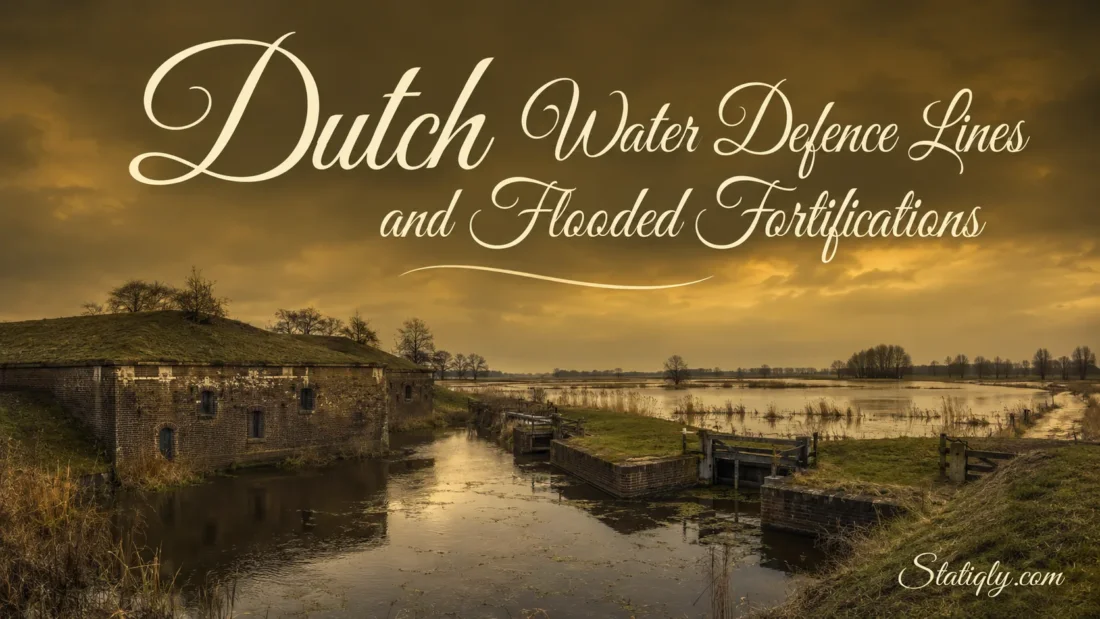
Across the lowlands of the Netherlands, forts, canals, dikes, sluices, and open fields form one connected heritage landscape. These are the Dutch Water Defence Lines, a system designed to place a controlled sheet of water across selected polders. The water would be deep enough to hinder movement but too shallow for ordinary boats. What may look like a quiet meadow today was once part of a carefully measured hydraulic system.
The name covers two linked systems: the New Dutch Waterline and the Defence Line of Amsterdam. Together, they extend for more than 200 kilometres and include 96 forts, as well as dikes, canals, pumping stations, sluices, fortified towns, castles, and former inundation fields. UNESCO recognizes the entire system as a cultural landscape.
The Two Water Defence Systems
| Feature | New Dutch Waterline | Defence Line Of Amsterdam |
|---|---|---|
| Original Dutch name | Nieuwe Hollandse Waterlinie | Stelling van Amsterdam |
| General form | A long north-to-south line | A broad ring around Amsterdam |
| Approximate length | 85 kilometres | 135 kilometres |
| Development period | Construction began in 1815, followed by later additions | Mainly developed during the late 19th and early 20th centuries |
| Geographic reach | From the Muiden area towards the Biesbosch | Across the landscape surrounding Amsterdam |
| Visible character | Brick forts, concrete shelters, fortified towns, canals, dikes, and sluices | Concrete forts, ring canals, dikes, sluices, and open polder fields |
| UNESCO history | Added to the existing World Heritage property in 2021 | First inscribed on the World Heritage List in 1996 |
The figures describe two parts of one connected landscape. Boundaries overlap with rivers, settlements, agricultural areas, and present-day infrastructure, so the lines do not resemble a continuous wall.
How Controlled Flooding Worked
The Dutch term inundatie refers to the planned flooding of a defined area. It did not mean placing an entire province under water. Engineers selected low polders and divided them into separate inundation basins. Each basin had its own water controls.
Water Entered Through A Managed Network
Rivers, lakes, canals, and tidal waters supplied the system. Sluices directed water into canals, while smaller gates moved it towards individual fields. Dikes and raised embankments kept the water within planned limits. Where gravity could not move enough water, pumping installations supported the process.
- Water entered through a main inlet or sluice.
- Canals carried it towards one or more low-lying polders.
- Secondary gates distributed it across separate basins.
- Dikes, roads, and embankments controlled its spread.
- Operators monitored the depth and adjusted the flow.
The intended result was a wide, shallow flooded zone. Too deep to cross with ease, yet too shallow for normal navigation. That narrow depth range mattered. A little too much water could make boats useful, while too little would leave parts of the land passable.
Flooding Required Time And Precision
Opening one gate did not instantly create the barrier. Water had to pass through several channels and spread over fields with small differences in height. Soil conditions, water availability, wind, and the layout of each polder affected the process. Some sections could fill faster than others.
Careful coordination was essential. The defence lines were as much a water-management system as a collection of forts.
Why Forts Were Still Needed
Controlled flooding could cover broad areas, but it could not close every route. Railways, roads, riverbanks, dikes, and naturally higher ground remained above the planned water level. Forts stood near many of these dry passages.
They also protected important hydraulic structures. A sluice or canal junction could affect a large inundation basin, so engineers placed defensive works near points where water entered or crossed the line.
- Forts covered roads, waterways, raised ground, and hydraulic junctions.
- Batteries supported sections between larger forts.
- Group shelters offered protected positions within the landscape.
- Casemates provided enclosed spaces built from brick or concrete.
- Line dikes guided water while linking parts of the system.
- Sluices controlled the direction and volume of water.
The forts themselves were generally placed on dry ground. The phrase flooded fortifications can therefore be misleading: selected fields were flooded, while forts guarded the gaps and water controls.
A Landscape Shaped By Small Height Differences
The Netherlands may appear almost level, but centimetres can change the behaviour of water. Engineers studied these subtle differences and used existing polders, drainage channels, river branches, and embankments. The system worked with the land rather than replacing it.
Many inundation fields remained open because construction near the lines was restricted. Clear space around forts preserved long views across the surrounding land. These controlled zones were known as prohibited circles. Building rules differed according to distance and period, but the shared purpose was to keep the landscape open.
This history explains why some areas near large Dutch cities still contain broad green fields, straight canals, and isolated forts. The emptiness is not accidental. Once the pattern becomes familiar, the line starts to appear.
From The Old Waterline To The New Waterline
Dutch engineers had used controlled flooding for centuries before the present World Heritage property took shape. The earlier Old Dutch Waterline established a chain of inundation areas and fortified towns in the western Netherlands. Utrecht stood outside much of that older arrangement.
Construction of the New Dutch Waterline began in 1815. Its route placed Utrecht within the protected area and connected existing rivers, towns, castles, polders, and hydraulic works. New forts appeared at dry approaches, while older sites gained fresh roles.
The system changed repeatedly between 1815 and 1940. Brick forts received earth coverings, concrete shelters appeared, and hydraulic controls were adjusted. Each layer records the engineering knowledge and construction methods of its period.
The Ring Around Amsterdam
The Defence Line of Amsterdam formed a wide ring around the capital. Its route followed polders and waterways rather than the modern urban edge. The complete circuit measures roughly 135 kilometres.
Most of its main forts were built with concrete and covered by soil. From a distance, many resemble low green mounds rather than monumental buildings. Their subdued form helped them merge with the flat landscape.
Fort sites stood near rail lines, roads, waterways, or raised polder edges that crossed the planned inundation belt. Ring canals, dams, sluices, and fields completed the system. A fort viewed alone tells only part of the story; the surrounding water and open land explain why it occupies that exact spot.
Brick, Concrete, Earth, And Water
The water lines preserve a broad range of construction methods. Earlier forts often relied on brick vaults covered by thick layers of earth. Later structures used concrete, including early forms of unreinforced concrete. Steel also appeared in doors, shutters, fittings, and protected positions.
Earth-Covered Forts
Soil helped protect buildings and softened their outline. Grass-covered roofs also make many forts hard to recognize from surrounding fields. Their interiors may contain vaulted rooms, corridors, storage spaces, and ventilation shafts.
Concrete Forts And Shelters
Concrete allowed thicker, more compact structures. The Defence Line of Amsterdam is especially useful for studying the shift from brick construction towards concrete. Along the New Dutch Waterline, visitors can see several generations of buildings within a relatively small area.
Hydraulic Structures
Sluices may look modest beside a large fort, yet they reveal how the system functioned. Some controlled a single canal. Others influenced several basins. Dams, culverts, quays, and channels linked these controls to the wider landscape.
Why UNESCO Recognizes The Water Lines
The Defence Line of Amsterdam entered the UNESCO World Heritage List in 1996. In 2021, the listed property expanded to include the New Dutch Waterline and adopted the shared name Dutch Water Defence Lines.
UNESCO recognizes more than individual buildings. The protected heritage includes three connected parts:
- The strategically arranged landscape, including open inundation fields and controlled sightlines.
- The water-management network, formed by canals, dikes, sluices, pumping facilities, and polders.
- The fortifications, including forts, batteries, shelters, fortified towns, and related structures.
Remove one part and the others become harder to understand. A sluice needs its canal and polder. A fort needs the dry route it watched. An open field needs its dikes and water inlet. Their relationship gives the site its identity.
Places That Explain The System Clearly
Waterline Museum At Fort Vechten
Fort Vechten stands near Utrecht within the New Dutch Waterline. Its museum explains how inundation basins, forts, and hydraulic works operated together. The site works well as a starting point because the wider landscape can be difficult to read without an introduction.
Fort Island Pampus
Pampus occupies an artificial island near Amsterdam. Reached by boat when services operate, it presents the maritime side of the Defence Line of Amsterdam. Its isolated position also shows that the ring depended on waterways as well as polders.
Fort Near Krommeniedijk
Also known as Fort K’IJK, this site lies in the northern part of the Amsterdam line. The fort and its surroundings help visitors connect the architecture with the open polder landscape.
Fort Pannerden
Fort Pannerden stands near the meeting point of major waterways in the eastern section of the New Dutch Waterline. Its elevated viewpoints reveal how rivers, channels, and dry approaches shaped the location of a fort.
Muiderslot And Loevestein Castle
The medieval castles of Muiderslot and Loevestein were older than the 19th-century water lines, yet both became part of the connected system. They show how engineers reused established sites instead of treating the landscape as an empty surface.
Gorinchem And Other Fortified Towns
Fortified towns add streets, gates, ramparts, and harbours to the waterline story. Gorinchem is especially useful for seeing how a lived-in town, river setting, and defensive landscape meet in one place.
How To Read The Landscape
Look beyond the fort entrance. The most revealing features often sit outside the walls.
- Find the nearest waterway. A canal, river branch, or ring ditch may have supplied or distributed water.
- Notice raised routes. Roads, railway beds, and dikes often crossed areas intended for inundation.
- Look for sluices and gates. Their direction can reveal where the water entered and where it was meant to flow.
- Observe the open fields. Flat, lightly developed land may preserve a former inundation basin.
- Check the fort’s position. It often faces a route or water control that could not be covered by flooding.
- Compare materials. Brick, concrete, steel, and earth coverings point to different construction phases.
A map helps. Better still, walk or cycle slowly enough to notice how one feature leads to another.
Planning A Visit
The Dutch Water Defence Lines cover too much ground for a single short visit. Choosing one geographic cluster makes the experience easier and leaves time to study the landscape between sites.
- For museum interpretation: begin around Fort Vechten.
- For an island fort: consider Pampus and check boat schedules before travelling.
- For canals and polders: explore a cycling route through the Amsterdam ring.
- For castles and fortified towns: combine Loevestein with nearby Gorinchem.
- For river engineering: visit the landscape around Fort Pannerden.
Many forts have new cultural, educational, recreational, or ecological uses. Public access varies. Some buildings open only on selected days, while others remain private or serve as protected natural areas. Check the individual location before setting out.
Weather also changes the experience. After rain, unpaved routes can become soft, and low winter light makes dikes and earthworks easier to see. Binoculars can help with distant hydraulic features, while a downloaded map remains useful where mobile reception is uneven.
Common Questions About The Dutch Water Defence Lines
Were The Forts Deliberately Flooded?
No. The planned inundation covered selected fields and polders. Forts normally stood on dry or raised ground beside routes, waterways, and hydraulic controls.
Are The New Dutch Waterline And The Amsterdam Line The Same?
No. They are separate but related systems. The New Dutch Waterline follows an elongated route through the central Netherlands, while the Defence Line of Amsterdam forms a ring around Amsterdam. Together they make up the UNESCO property.
Can The Former Inundation Fields Still Be Seen?
Yes, although they usually appear as ordinary farmland, wetlands, or open green space. Dikes, straight canals, sluices, and the position of nearby forts help identify them.
Did The System Depend Only On Water?
No. Water covered broad low areas, while forts and smaller structures occupied dry passages and protected control points. Roads, dikes, canals, rivers, and open sightlines all had a role.
Why Do Some Forts Look Like Green Hills?
Many were covered with thick layers of earth. The covering protected the structure, regulated interior temperature, and reduced its visual profile within the landscape.
Can Visitors Explore The Entire Route By Bicycle?
Long-distance cycling routes connect many sections of the waterline landscape. Shorter local routes are also available. Access to individual fort interiors depends on opening times, events, ownership, and conservation needs.
What Makes The Site Different From A Group Of Forts?
The forts were only one layer. The heritage value comes from the surviving relationship between buildings, water controls, polders, canals, dikes, and deliberately open land. Seen together, these elements turn an apparently ordinary Dutch landscape into a readable work of hydraulic engineering.