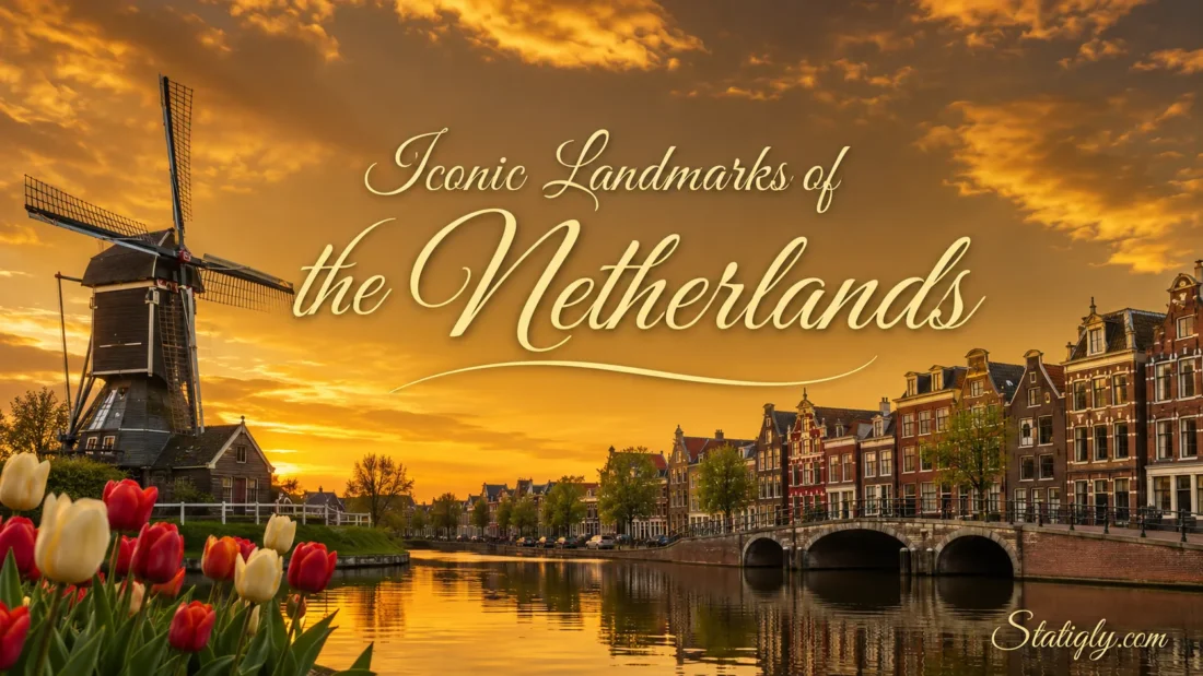
Few countries tie land, water, architecture, and daily life together as visibly as the Netherlands. Its best-known landmarks range from canal houses and working windmills to daring modern buildings, vast flower gardens, medieval towers, and immense water-control structures. Each place reveals a different side of Dutch design: practical, precise, and closely shaped by its surroundings.
Amsterdam holds many familiar sights, yet the story extends far beyond the capital. Rotterdam experiments with form. Utrecht and Delft rise around historic towers. Kinderdijk explains how wind once moved water, while the Afsluitdijk shows that idea on a national scale. Together, these places form a clear picture of how the Netherlands looks, works, and builds.
Landmarks Across The Netherlands
| Landmark | Location | Known For | Main Period |
|---|---|---|---|
| Amsterdam Canal Ring | Amsterdam | Concentric canals and gabled houses | Late 16th and 17th centuries |
| Rijksmuseum | Amsterdam | Gothic and Renaissance-inspired architecture | Opened in 1885 |
| Royal Palace Amsterdam | Amsterdam | Classical civic architecture and marble interiors | Built from 1648 |
| Kinderdijk Windmills | South Holland | Historic water-management system with 19 windmills | Around 1740 |
| Zaanse Schans | North Holland | Historic mills and green timber houses | Buildings from several periods |
| Keukenhof | Lisse | Seasonal displays of spring-flowering bulbs | Opened in 1950 |
| Dom Tower | Utrecht | The country’s tallest church tower | 14th century |
| Rietveld Schröder House | Utrecht | De Stijl architecture and flexible rooms | Built in 1924 |
| Nieuwe Kerk Tower | Delft | Delft’s 108.75-metre church tower | Completed and altered over several centuries |
| Erasmus Bridge | Rotterdam | Asymmetrical pylon and cable-supported span | Completed in 1996 |
| Cube Houses | Rotterdam | Homes tilted at 45 degrees | Completed in the 1980s |
| Markthal | Rotterdam | Arched market hall combined with homes | Opened in 2014 |
| Afsluitdijk | North Holland and Friesland | 32-kilometre water barrier | Completed in 1932 |
| Wadden Sea | Northern Coast | Tidal flats, islands, channels, and salt marshes | Natural coastal landscape |
| Saint Servatius Basilica | Maastricht | One of the country’s oldest surviving churches | Medieval origins |
| Giethoorn Waterways | Overijssel | Canals, footpaths, wooden bridges, and farmhouses | Historic village landscape |
Why Dutch Landmarks Look So Distinct
Dutch landmarks often grow from a practical need. Canals drained wet ground and carried goods. Windmills pumped water or powered workshops. Tall church towers helped define cities built on largely level land. Later, bridges, barriers, and experimental homes carried the same practical spirit into new forms.
- Water shapes the setting: canals, rivers, tidal flats, dikes, and reclaimed land appear beside many famous sites.
- Brick gives cities their texture: narrow brick houses, churches, warehouses, and civic buildings create warm, detailed streets.
- Height stands out: towers and windmills remain visible across flat surroundings.
- Old structures still work: several mills, waterways, churches, markets, and bridges continue to serve real purposes.
- Modern design welcomes experiments: Rotterdam and Utrecht contain buildings that test familiar ideas about homes, public space, and movement.
Amsterdam Canal Ring
The Amsterdam Canal Ring is not a single monument. It is a planned urban landscape formed by waterways, bridges, streets, and rows of narrow houses. Builders developed its best-known sections during Amsterdam’s expansion in the late 16th and 17th centuries.
Herengracht, Keizersgracht, and Prinsengracht curve around the older centre in broad arcs. Smaller canals and streets connect them, creating a layout that feels orderly from above and varied at ground level. Bell gables, neck gables, stepped forms, lifting beams, and tall windows give individual houses their identities.
The canal district also shows how builders adapted to soft, wet ground. Many houses stand on deep timber foundations. Narrow plots encouraged tall buildings, while hoisting beams helped residents move goods and furniture through upper windows. The 17th-century canal ring inside the Singelgracht joined the UNESCO World Heritage List in 2010.
Details Worth Noticing
- The changing shapes of the house gables
- Small differences in façade width and window spacing
- Bridges that create long views across several canals
- Former warehouses with large shutters and lifting hooks
- Trees that soften the strict lines of brick and water
Rijksmuseum
Architect Pierre Cuypers designed the Rijksmuseum as a blend of Gothic and Renaissance-inspired forms. The building officially opened in 1885 and now anchors Amsterdam’s Museumplein. Its towers, pointed windows, decorated brickwork, and sculpted details give it the presence of both a palace and a grand city gate.
A public passage runs directly through the centre of the building. Cyclists and pedestrians use it every day, which gives the museum an unusual connection with the surrounding city. Inside, the galleries present roughly 800 years of Dutch art and history. The building itself remains part of the experience: tiled scenes, painted ceilings, stained glass, and the Cuypers Library reward anyone who looks beyond the displays.
Royal Palace Amsterdam
The Royal Palace on Dam Square began life as Amsterdam’s town hall. Jacob van Campen designed it in the Dutch Classical style, and construction started in 1648. The building entered use in 1655, although work continued afterward. In 1808, it became a palace.
Its calm sandstone exterior hides a much more elaborate interior. The Citizen’s Hall measures about 34 metres long and 25 metres high. Marble floors, reliefs, sculptures, and enormous circular maps turn the hall into a carefully ordered picture of the wider world. Supporting such a heavy structure on Amsterdam’s soft soil required 13,659 timber piles. Invisible below ground, they are as remarkable as the rooms above.
Kinderdijk Windmills
At Kinderdijk, 19 historic windmills stand beside canals and low fields in the Alblasserwaard. Most were built around 1740 as part of a wider system created to move excess water out of the polders. The landscape explains Dutch water management without needing much interpretation: land lies low, channels collect water, and mills help lift it toward higher waterways.
The mills are arranged in two main rows. Long views across reeds, water, paths, and turning sails make Kinderdijk one of the country’s most recognisable scenes. Yet this is a working cultural landscape rather than a row of decorative structures. Pumps now carry much of the load, while the mills preserve the earlier method and remain ready for operation.
UNESCO added the Mill Network at Kinderdijk-Elshout to its World Heritage List in 1997. The protected area includes more than windmills. Dikes, reservoirs, drainage channels, pumping stations, and administrative buildings all belong to the water system.
Zaanse Schans
Zaanse Schans preserves the timber architecture and industrial mill heritage of the Zaan region. Historic houses, workshops, warehouses, and windmills stand along paths and waterways near Zaandam. Their green-painted façades and white trim create one of North Holland’s most familiar views.
The site is a carefully assembled heritage village. Plans for preserving Zaan buildings developed during the 1940s, and the first house reached the area in 1959. Other structures followed by road and water. The foundation responsible for the village was established in 1961, and the site officially opened in 1972.
The surrounding region once held hundreds of industrial windmills. They sawed timber and processed materials used for paper, pigments, spices, and oils. Several surviving mills at Zaanse Schans still demonstrate these tasks. This industrial role separates the site from Kinderdijk, where the best-known mills primarily managed water.
Keukenhof
Near Lisse, Keukenhof turns flower cultivation into landscape design. The park opened to the public in 1950 and received 236,000 visitors in its first season. Its displays now use about seven million spring-flowering bulbs supplied by growers.
Tulips receive much of the attention, but the plantings also include daffodils, hyacinths, crocuses, and other bulb flowers. Gardeners plant them in carefully timed layers so different varieties bloom across the short spring season. Curving beds, old trees, ponds, lawns, and pavilions keep the park from feeling like a single vast field.
Keukenhof is seasonal. Its public opening dates change each year and cover only part of spring, so current dates should always be checked before a visit.
Dom Tower Of Utrecht
Rising 112.32 metres, the Dom Tower is the tallest church tower in the Netherlands. Its Gothic form dominates Utrecht’s centre and remains visible from far beyond the old streets. Construction took place during the 14th century, leaving the city with a landmark that has stood for about seven centuries.
The tower now stands apart from the cathedral. A severe storm in 1674 brought down the cathedral nave that once connected them, leaving the open space known as Domplein. The separation makes the tower’s scale easier to read from ground level.
Visitors who climb the tower pass stone stairways, bell chambers, and the carillon before reaching the upper viewing level. The exterior underwent a full restoration between 2019 and 2024, preserving its carved stone and architectural details.
Rietveld Schröder House
The Rietveld Schröder House looks modest beside the Netherlands’ large churches and civic buildings. Its influence comes from ideas, not size. Gerrit Thomas Rietveld designed the Utrecht home for Truus Schröder-Schräder, and construction finished in 1924.
White and grey planes, dark lines, and accents of red, blue, and yellow express the visual language associated with De Stijl. Inside, sliding and rotating partitions allow the upper floor to change from one open area into separate rooms. Walls stop acting like fixed boundaries. Space moves.
UNESCO recognised the house as a World Heritage Site in 2000. Because the interior forms part of the design, controlled visits usually require advance arrangements.
Nieuwe Kerk Tower In Delft
Delft’s Markt square gains much of its character from the pale stone façade and dark spire of the Nieuwe Kerk. Work on the church began in the late 14th century. After later rebuilding and alterations, its tower reached its present height of 108.75 metres, making it the Netherlands’ second-tallest church tower.
The dark upper section may look smoke-stained, but weathering caused much of its colour. Pierre Cuypers designed the current spire during the 19th century. A climb of 376 steps leads to a viewing level about 85 metres above the square, with broad views over Delft and, in clear weather, toward neighbouring cities.
Erasmus Bridge
The Erasmus Bridge carries traffic, trams, cyclists, and pedestrians across the Nieuwe Maas in Rotterdam. Completed in 1996, the bridge extends for roughly 800 metres. Its 139-metre asymmetrical steel pylon supports the deck through 40 cables.
The angled pylon has earned the bridge the nickname “The Swan.” Seen from the riverbanks, it connects Rotterdam’s northern centre with the Kop van Zuid district while giving the skyline a clear visual focus. Walkers can study the changing cable pattern at close range and watch river traffic passing below.
Cube Houses
Architect Piet Blom designed Rotterdam’s Cube Houses as an experiment in dense urban living. Each main living space takes the form of a cube tilted 45 degrees and balanced on a hexagonal support. The completed group stands above a pedestrian area near Blaak station and the Oude Haven.
Blom imagined each house as a tree and the collection as an urban forest. The tilted walls create rooms that feel very different from their exterior shape. Windows point down toward public paths or up toward the sky, while awkward corners become storage and furniture areas. One furnished show house allows visitors to see how the geometry works in daily life.
Markthal Rotterdam
The Markthal combines an indoor food market, shops, parking, and apartments within one horseshoe-shaped structure. Opened in 2014, it stands near the Cube Houses, Rotterdam Blaak station, and the medieval Grote Kerk.
A broad glass wall closes each end while preserving views through the hall. Apartments curve above the market floor, placing homes inside the arch rather than beside it. Across the inner surface, an enormous artwork filled with fruits, vegetables, flowers, and insects gives the hall its vivid identity. Architecture, housing, and everyday shopping share one space here.
Afsluitdijk
The Afsluitdijk stretches for 32 kilometres between North Holland and Friesland. Completed in 1932, it separated the former Zuiderzee from the Wadden Sea. The enclosed water gradually became the freshwater IJsselmeer.
From a distance, the structure can appear to be a simple road crossing the water. Its real scale becomes clear when travelling along it: water extends toward the horizon on both sides, while locks and sluices regulate shipping and water discharge. The barrier remains a working part of Dutch water management and transport.
Wadden Sea
The Netherlands also has a natural landmark shaped by water rather than architecture. The Wadden Sea forms the largest unbroken system of intertidal sand and mud flats on Earth. The wider UNESCO site continues along the German and Danish coasts.
Twice each day, tides alter the visible landscape. Channels fill, flats disappear, and later wide areas of sand and mud return. Dunes, salt marshes, beaches, tidal channels, mussel beds, and seagrass areas support many forms of life. The region is especially valuable for migratory birds, with millions passing through during seasonal movements.
Saint Servatius Basilica In Maastricht
On Maastricht’s Vrijthof stands the Basilica of Saint Servatius, commonly regarded as the oldest surviving church in the Netherlands. The building developed over many centuries above the traditional burial place of Saint Servatius.
Its heavy stone walls, rounded Romanesque arches, twin western towers, cloister, and treasury differ sharply from the narrow brick architecture associated with northern Dutch cities. The basilica helps explain Maastricht’s distinct appearance and its long connection with the wider Meuse region.
Giethoorn Waterways
Giethoorn’s landmark is the village layout itself. Canals pass beside thatched farmhouses, gardens, footpaths, and scores of small wooden bridges. Much of the historic centre has no conventional street running past the homes, so residents and visitors move through it by boat or on foot.
The waterways developed through centuries of digging and local land use. Narrow plots and individual bridges now create the scene for which Giethoorn is known. It feels intimate rather than monumental. Quiet details carry the view: reeds beside the water, low boats passing under bridges, and roofs reflected in the canals.
Choosing Landmarks By Interest
- For water engineering: Kinderdijk, the Afsluitdijk, and Amsterdam’s canal ring
- For medieval architecture: Utrecht’s Dom Tower, Delft’s Nieuwe Kerk, and Saint Servatius Basilica
- For modern design: the Rietveld Schröder House, Cube Houses, Markthal, and Erasmus Bridge
- For windmills: Kinderdijk for drainage history and Zaanse Schans for industrial milling
- For seasonal landscapes: Keukenhof during its spring opening
- For natural scenery: the Wadden Sea and its tidal coastline
- For canal villages: Giethoorn and the historic centre of Amsterdam
Planning A Landmark Route
Several landmarks fit naturally into regional groups. Amsterdam, Zaanse Schans, and Keukenhof cover city architecture, industrial heritage, and seasonal gardens in western Netherlands. Rotterdam, Delft, and Kinderdijk create another useful group, with short distances between modern buildings, historic towers, and windmill landscapes.
Utrecht combines the Dom Tower and Rietveld Schröder House in one city, though they represent very different periods. Maastricht works better as a separate southern stop. Giethoorn and the Wadden Sea belong to wider northern or eastern routes where travel times are longer and the landscape matters as much as the destination.
- Group nearby places rather than crossing the country several times.
- Check reservations for small interiors such as the Rietveld Schröder House.
- Confirm seasonal access before planning around Keukenhof.
- Allow extra time at Kinderdijk and the Wadden Sea, where walking is part of the experience.
- Check current maintenance notices for towers, bridges, and water structures.
Common Questions About Dutch Landmarks
What Is The Most Recognisable Landmark In The Netherlands?
The Kinderdijk windmills and Amsterdam Canal Ring are among the most widely recognised. Kinderdijk represents the close relationship between wind, water, and reclaimed land, while Amsterdam’s canals provide the country’s most familiar urban scene.
Are Kinderdijk and Zaanse Schans The Same Type Of Site?
No. Kinderdijk preserves a connected drainage landscape centred on 19 windmills. Zaanse Schans is a heritage village containing relocated timber buildings and several types of industrial mills. Both feature windmills, but they tell different stories.
Which Dutch Landmark Is The Tallest Church Tower?
Utrecht’s Dom Tower is the tallest church tower in the Netherlands at 112.32 metres. The Nieuwe Kerk tower in Delft ranks second at 108.75 metres.
Which Landmarks Show Modern Dutch Architecture?
Rotterdam offers the strongest concentration through the Erasmus Bridge, Cube Houses, and Markthal. Utrecht’s Rietveld Schröder House presents an earlier form of Dutch modernism through its De Stijl design and adaptable interior.
Can The Main Landmarks Be Reached Without A Car?
Most urban landmarks are easy to reach by train, tram, metro, bus, bicycle, or on foot. Sites outside city centres may require an added local bus, bicycle ride, ferry, or organised transfer. Public transport planning is especially useful for Kinderdijk, Keukenhof, Giethoorn, and parts of the Wadden coast.