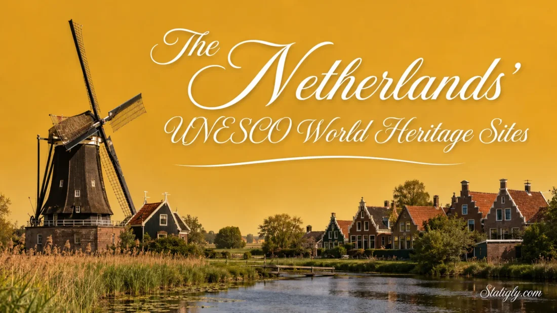
Few countries reveal the relationship between people, land, and water as clearly as the Netherlands. Its UNESCO World Heritage Sites include reclaimed polders, working water systems, modern architecture, archaeological landscapes, a moving planetarium, and one vast tidal ecosystem. Together, these places show how Dutch communities have shaped their surroundings through engineering, planning, science, and design.
The UNESCO World Heritage List records 13 properties under the Kingdom of the Netherlands. Twelve are cultural sites and one is a natural site. Twelve lie in the European Netherlands, while the Historic Area of Willemstad is in Curaçao. Three properties are shared with neighboring countries.
The 13 Inscribed Properties
| World Heritage Property | Main Location | Inscription | Type | Defining Feature |
|---|---|---|---|---|
| Schokland and Surroundings | Flevoland | 1995 | Cultural | A former island preserved within reclaimed land |
| Dutch Water Defence Lines | Western and central Netherlands | 1996; extended 2021 | Cultural | Forts, dikes, canals, sluices, and controlled-inundation fields |
| Historic Area of Willemstad | Curaçao | 1997 | Cultural | A Caribbean harbor city with distinct historic districts |
| Mill Network at Kinderdijk-Elshout | South Holland | 1997 | Cultural | Nineteen windmills within a working drainage landscape |
| D.F. Wouda Steam Pumping Station | Lemmer, Friesland | 1998 | Cultural | The largest steam-powered pumping station ever built |
| Beemster Polder | North Holland | 1999 | Cultural | A geometric 17th-century reclaimed landscape |
| Rietveld Schröder House | Utrecht | 2000 | Cultural | A De Stijl house with flexible interior spaces |
| Wadden Sea | Northern coast and islands | 2009; extended 2014 | Natural | The world’s largest continuous intertidal sand-and-mud-flat system |
| Amsterdam Canal Ring | Amsterdam | 2010 | Cultural | A planned network of concentric 17th-century canals |
| Van Nellefabriek | Rotterdam | 2014 | Cultural | Glass, steel, and reinforced-concrete industrial architecture |
| Colonies of Benevolence | Drenthe and Belgium | 2021 | Cultural | Planned agricultural settlements created for social reform |
| Lower German Limes | Rhine corridor and Germany | 2021 | Cultural | Archaeological remains along the former Roman frontier |
| Eisinga Planetarium in Franeker | Franeker, Friesland | 2023 | Cultural | The oldest continuously operating planetarium |
How the UNESCO List Is Organized
A World Heritage property is not always one building or one enclosed attraction. Some Dutch entries cover broad landscapes, while others contain many separate components. The Lower German Limes, for example, follows a long archaeological corridor. The Dutch Water Defence Lines connect forts and waterworks across several provinces.
- 12 cultural properties represent architecture, engineering, settlement planning, archaeology, and science.
- One natural property, the Wadden Sea, protects an active coastal ecosystem.
- Three transnational properties cross national boundaries: the Wadden Sea, Colonies of Benevolence, and Lower German Limes.
- One property lies in Curaçao and appears in UNESCO’s record for the Kingdom of the Netherlands.
Landscapes Shaped by Water
Schokland and Surroundings
Schokland was the Netherlands’ first World Heritage Site, inscribed in 1995. It once formed a peninsula and later became an island. Rising water pressure eventually led to its evacuation in 1859. Land reclamation changed the setting again during the 20th century, leaving the former island surrounded by the dry fields of the Noordoostpolder.
The landscape holds evidence of human activity stretching back thousands of years. Settlement mounds, former shorelines, archaeological remains, church ruins, and traces of an old harbor help visitors read its changing geography. Subtle, yet revealing, is the difference in elevation between Schokland and the surrounding farmland.
This is not a heritage site dominated by one large monument. Its value comes from the relationship between archaeology, water history, and the reclaimed landscape.
Dutch Water Defence Lines
The Dutch Water Defence Lines extend for more than 200 kilometers. Their network contains 96 forts as well as dikes, canals, pumping stations, sluices, and low-lying fields that could be temporarily flooded in a controlled manner.
The Defence Line of Amsterdam entered the UNESCO list in 1996. In 2021, UNESCO expanded the property to include the New Dutch Waterline and adopted the present name. The full system was developed mainly between 1815 and 1940.
Precise water control made the design work. Engineers needed a level deep enough to obstruct movement across the land but too shallow for ordinary boats. That balance depended on coordinated sluices, canals, polders, and local water knowledge.
Because this is a serial property, experiences vary by location. Some sections center on forts, while others make the water-management pattern easier to see through open fields and canal networks.
Mill Network at Kinderdijk-Elshout
Kinderdijk preserves 19 windmills and three pumping stations within a broader system of dikes, reservoirs, waterways, and administrative buildings. The mills were not placed together for decoration. Each formed part of a coordinated method for moving excess water out of low-lying polders.
Water first moved from the polder into storage basins before being released toward the river when conditions allowed. Windmills handled much of this work in earlier periods; mechanical pumping stations later joined the system. The result is a readable timeline of Dutch drainage technology in one landscape.
Many travelers associate Dutch windmills with milling grain. Kinderdijk shows another purpose: managing water to keep settled and cultivated land usable.
D.F. Wouda Steam Pumping Station
Opened near Lemmer in 1920, the D.F. Wouda Steam Pumping Station is the largest steam-powered pumping station ever built. It remains operational and can still assist with water management when conditions require extra pumping capacity.
The property includes the engine hall, boiler house, chimney, inlet sluice, drainage canal, and connected waterways. Its long horizontal form gives the machinery space a clear, orderly layout. Brick architecture and large windows also show that an industrial utility could receive careful architectural treatment.
Inside, steam engines drive large centrifugal pumps. The machinery turns an abstract idea about water control into something visible: energy enters the system, engines transfer it, and enormous volumes of water move through the station.
Beemster Polder
The Beemster Polder began with the drainage of Lake Beemster in 1612. The project created 7,208 hectares of reclaimed land north of Amsterdam. Roads, canals, fields, and settlements were arranged within a measured geometric plan.
Its basic plots measure about 180 by 900 meters. Groups of plots form larger square modules, while roads and waterways run mainly from north to south and east to west. The former lake’s outline remains visible around this ordered interior.
The landscape still supports agriculture, so Beemster is not a frozen historical display. Tree-lined roads, drainage channels, farmsteads, villages, and the ring canal continue to shape daily use. Best understood from several viewpoints, it reveals its design slowly.
Amsterdam’s Seventeenth-Century Canal Ring
Amsterdam’s UNESCO designation covers the 17th-century canal district inside the Singelgracht, not the entire city. The planned expansion used concentric canals to drain wet ground, organize transport, and create space for rows of narrow urban houses.
Herengracht, Keizersgracht, and Prinsengracht form the district’s familiar arcs. Bridges, canal-side trees, warehouses, inner courtyards, and gabled houses complete the urban pattern. Individual façades attract attention, but UNESCO recognizes the larger ensemble.
The canal ring works as both infrastructure and city plan. Water routes determined plot shapes, street lines, building widths, and the movement of goods. Few places make historic hydraulic planning so easy to experience on foot.
Architecture and Scientific Design
Rietveld Schröder House
Architect Gerrit Thomas Rietveld designed the Rietveld Schröder House for Truus Schröder-Schräder. Completed in Utrecht in 1924, the house translates the ideas of De Stijl into a complete living environment.
Horizontal and vertical planes appear to slide past one another. White and gray surfaces are punctuated by red, blue, yellow, and black details. Inside, movable partitions allow the upper floor to change from one open area into separate rooms.
Furniture, storage, windows, colors, and circulation were designed as parts of the same composition. Small in scale, broad in influence. The house became an enduring reference for modern architects interested in flexible domestic space.
Van Nellefabriek
Built during the 1920s beside a canal in Rotterdam’s Spaanse Polder, Van Nellefabriek represents a new approach to industrial architecture. Reinforced-concrete structures support long façades of steel and glass curtain walls, allowing daylight to reach deep into the work areas.
The complex organized production, storage, transport, and office functions through connected buildings. Enclosed bridges once carried materials between different parts of the factory. Open interior floors could adapt as production needs changed.
The site now serves new working uses while retaining its industrial form. It is not an ordinary walk-in museum, so public access may depend on scheduled tours, events, or designated opening arrangements.
Eisinga Planetarium in Franeker
Eise Eisinga built his mechanical model of the solar system between 1774 and 1781. Installed in the ceiling and wall of his former living room, it is recognized as the oldest continuously operating planetarium in the world.
A single pendulum clock drives the mechanism. The model displays the real-time positions of the Sun, Moon, Earth, Mercury, Venus, Mars, Jupiter, and Saturn—the planets known when Eisinga designed it. Orbital movement unfolds at its correct relative pace, while planetary distances follow a reduced scale.
Its domestic setting makes the achievement especially clear. This is not a machine filling a purpose-built hall. It occupies the ceiling of an ordinary room, with the gears hidden above. UNESCO inscribed the property in 2023, making it the newest Dutch entry on the list.
Archaeological and Planned Settlements
Frontiers of the Roman Empire: The Lower German Limes
The Lower German Limes follows the left bank of the Lower Rhine for roughly 400 kilometers across the Netherlands and Germany. Its 102 components preserve evidence of settlements and infrastructure dating mainly from the first to fifth centuries CE.
Archaeologists have identified forts, roads, harbors, canals, civilian settlements, temples, cemeteries, and an aqueduct along the route. Much of the material remains below ground. Wet soil has preserved wood, leather, and other organic materials that rarely survive at drier archaeological sites.
Why visit a property whose remains are often buried? Museums, reconstructed features, marked routes, and landscape interpretation reveal how the Rhine connected communities and shaped settlement. Nijmegen, Utrecht, and the western Rhine corridor provide useful starting points for exploring the Dutch components.
Colonies of Benevolence
The Colonies of Benevolence form a transnational cultural landscape shared by the Netherlands and Belgium. The Dutch components are Frederiksoord-Wilhelminaoord and Veenhuizen; the Belgian component is Wortel.
Beginning in 1818, these planned agricultural settlements were created as a 19th-century social reform experiment intended to reduce urban poverty through housing, education, work, and farming. Straight roads, planted avenues, rectangular fields, farmhouses, institutional buildings, and shared facilities expressed that organized approach.
Frederiksoord-Wilhelminaoord used smaller farms arranged for families. Veenhuizen developed larger buildings and centralized agricultural units. Their contrasting layouts make the social ideas behind each settlement visible in the landscape.
Historic Area of Willemstad, Curaçao
Willemstad developed around the natural harbor of Sint Anna Bay from the 17th century onward. Its UNESCO property covers 86 hectares and includes four historic districts: Punda, Otrobanda, Pietermaai, and Scharloo.
The city combines Dutch planning traditions with Caribbean conditions, regional craftsmanship, and architectural influences from Iberian-American port cities. Galleries, shaded spaces, curved gables, and colorful exterior finishes give the districts their local character.
Water separates and connects the historic quarters. Punda has a compact street plan, while Otrobanda developed with larger plots and different residential forms. Scharloo and Pietermaai add further layers to the harbor city’s architectural story.
The Netherlands’ Only Natural World Heritage Site
Wadden Sea
The Wadden Sea is shared by the Netherlands, Germany, and Denmark. UNESCO describes it as the largest unbroken system of intertidal sand and mud flats in the world. Tides continuously reshape its channels, sandbanks, mudflats, salt marshes, beaches, and dunes.
The full World Heritage property covers more than 1.14 million hectares. Around 10 to 12 million migratory birds pass through the wider ecosystem during an average year, using it as a place to rest, feed, breed, or spend the winter. Seals, porpoises, fish, shellfish, and salt-tolerant plants also depend on its connected habitats.
A Wadden Sea visit changes with the tide. At high water, channels and shallow sea dominate the view. As the water retreats, broad mudflats appear. Visitors should follow local access rules, marked routes, and wildlife guidance because this is a living protected ecosystem rather than a fixed scenic monument.
Planning Visits by Region
Several properties can be combined geographically, although the serial sites may require more than one stop to understand fully.
- Amsterdam and North Holland: Combine the Amsterdam Canal Ring with Beemster Polder and selected sections of the Dutch Water Defence Lines.
- Utrecht and the Rhine corridor: Pair the Rietveld Schröder House with components of the Lower German Limes and nearby water-line landscapes.
- Rotterdam and South Holland: Van Nellefabriek and Kinderdijk present two very different forms of technical design.
- Friesland and Flevoland: Franeker Planetarium, the Wouda Pumping Station, Schokland, and the Dutch Wadden region create a strong northern route.
- Drenthe: Frederiksoord-Wilhelminaoord and Veenhuizen reveal the Dutch sections of the Colonies of Benevolence.
- Curaçao: Willemstad requires a separate Caribbean journey and should not be treated as part of a European Netherlands itinerary.
Before Choosing a Site
- Check whether the property is a single building, an open landscape, or a serial group of locations.
- Reserve ahead for small interiors and sites that use timed admission.
- Confirm public access for working buildings such as Van Nellefabriek and the Wouda Pumping Station.
- Use an interpretation center or museum when exploring archaeological properties with remains below ground.
- Check tides and local nature rules before entering coastal areas around the Wadden Sea.
Common Questions About Dutch World Heritage
How Many UNESCO World Heritage Sites Does the Netherlands Have?
UNESCO lists 13 World Heritage properties under the Kingdom of the Netherlands. Twelve are in the European Netherlands, and one is in Curaçao.
Which Dutch Site Was Inscribed First?
Schokland and Surroundings became the first Dutch World Heritage Site in 1995.
Which Property Is the Newest Addition?
The Eisinga Planetarium in Franeker joined the World Heritage List in 2023.
Which Dutch World Heritage Sites Cross Borders?
Three properties are transnational. The Wadden Sea is shared with Germany and Denmark. The Lower German Limes continues into Germany, while the Colonies of Benevolence include components in the Netherlands and Belgium.
Is Every Dutch Windmill Site on the UNESCO List?
No. UNESCO specifically recognizes the Mill Network at Kinderdijk-Elshout for its complete water-management landscape. Other well-known windmill locations do not share this World Heritage designation.
Are the Sites Free to Visit?
Open landscapes and urban districts can often be explored without general admission, but museums, historic interiors, guided tours, and visitor facilities may charge a fee. Access arrangements vary because several properties remain working buildings, protected natural areas, or inhabited neighborhoods.
Properties on the Tentative List
The UNESCO World Heritage List should not be confused with the Tentative List. A tentative property may be considered for nomination in the future, but it does not yet hold World Heritage status.
The current tentative entries recorded for the Kingdom of the Netherlands are Bonaire Marine Park and Plantations in West Curaçao. Neither is included in the official total of 13 inscribed properties.