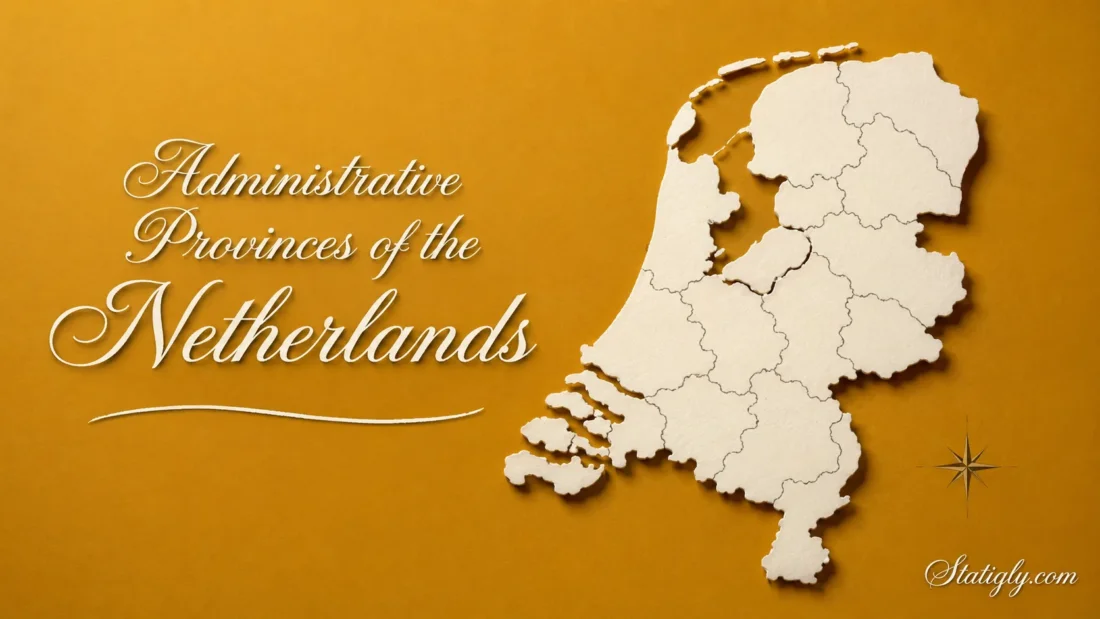
The Netherlands is divided into 12 administrative provinces. Each province connects national administration with municipalities and handles matters that cross local boundaries. Roads, regional transport, land use, nature management, and economic planning often fall within this provincial layer. Although the country is compact, its provinces differ greatly in landscape, urban development, language, and settlement patterns.
The 12 Provinces of The Netherlands
The present provincial map has existed since 1 January 1986, when Flevoland became the twelfth province. The official Dutch term for a province is provincie.
| English Name | Official Dutch Name | Provincial Capital | Broad Location |
|---|---|---|---|
| Groningen | Groningen | Groningen | Northern Netherlands |
| Friesland | Fryslân | Leeuwarden | Northern Netherlands |
| Drenthe | Drenthe | Assen | Northeastern Netherlands |
| Overijssel | Overijssel | Zwolle | Eastern Netherlands |
| Flevoland | Flevoland | Lelystad | Central Netherlands |
| Gelderland | Gelderland | Arnhem | Eastern-Central Netherlands |
| Utrecht | Utrecht | Utrecht | Central Netherlands |
| North Holland | Noord-Holland | Haarlem | Western and Northwestern Netherlands |
| South Holland | Zuid-Holland | The Hague | Western Netherlands |
| Zeeland | Zeeland | Middelburg | Southwestern Netherlands |
| North Brabant | Noord-Brabant | ’s-Hertogenbosch | Southern Netherlands |
| Limburg | Limburg | Maastricht | Southeastern Netherlands |
How Provinces Fit Into Dutch Administration
Dutch public administration has four main levels: central government, provinces, municipalities, and water authorities. Provinces occupy the middle position. Their work covers matters too broad for one municipality but too regional for direct national management.
Provinces, Municipalities, and Water Authorities
These administrative bodies have different responsibilities. Their boundaries can overlap because each one serves a separate purpose.
- Provinces coordinate regional land use, transport, nature, infrastructure, and economic development.
- Municipalities manage local services such as streets, neighbourhood planning, civil registration, and household waste collection.
- Water authorities manage water levels, regional waterways, wastewater treatment, and flood protection within their districts.
- Central government handles matters that apply across the country.
A water authority district does not have to follow a provincial border. Water systems determine its territory. This practical arrangement reflects the Netherlands’ close relationship with rivers, lakes, polders, and the North Sea.
How Provincial Government Works
Each province has a representative council called the Provincial States (Provinciale Staten). Residents elect its members every four years. The council sets provincial policy, approves spending, and checks the work of the provincial executive.
Day-to-day administration belongs to the Provincial Executive (Gedeputeerde Staten). Its members prepare decisions and carry out the plans approved by the provincial council.
A King’s Commissioner chairs both bodies. The commissioner is appointed for a six-year term and also represents central government within the province.
What Does A Dutch Province Manage?
The exact workload differs by province, yet the main responsibilities are similar across the country.
- Preparing regional plans for housing, business areas, agriculture, recreation, and nature
- Building and maintaining provincial roads, bridges, and cycle routes
- Coordinating parts of regional public transport
- Protecting nature areas and supporting landscape management
- Monitoring environmental rules within provincial responsibilities
- Supporting regional culture and economic development
- Supervising municipal finances and selected administrative duties
- Overseeing regional water authorities
Provincial choices often become visible through a bus route, a protected landscape, a new cycle connection, or the planned location of a residential area. Quiet work, much of it. Yet it shapes how places grow and connect.
Province-by-Province Profiles
Groningen
Groningen is the northeasternmost of the three northern provinces. Its capital, also named Groningen, serves as the province’s main urban, educational, and transport centre. Beyond the city, the province includes farmland, villages, waterways, and a coastline facing the Wadden Sea.
The province borders Germany to the east, Drenthe to the south, and Fryslân to the west. Regional transport matters here because settlements extend across a broad rural area while many services concentrate in Groningen city.
Friesland
Fryslân is the province’s official name, while Friesland remains the usual English form. Its capital is Leeuwarden, known as Ljouwert in West Frisian. Dutch and West Frisian both have an established place in provincial public life.
The province contains a lake-filled mainland and four inhabited West Frisian Islands: Vlieland, Terschelling, Ameland, and Schiermonnikoog. Texel belongs to North Holland. Water, agriculture, sailing routes, nature areas, and island connections all influence provincial planning in Fryslân.
Drenthe
Drenthe lies between Groningen, Fryslân, Overijssel, Germany, and a short border with Gelderland. Assen is the provincial capital, while Emmen is another large urban centre.
Forests, heathlands, peat landscapes, farmland, and smaller settlements give Drenthe a different pattern from the densely built western provinces. The province coordinates regional roads and transport while balancing residential development with open land and nature.
Overijssel
Overijssel stretches across the eastern Netherlands, with Zwolle as its capital. Enschede, Deventer, Hengelo, and Almelo are other major urban centres. The province borders Germany and connects the northern, central, and eastern parts of the country.
Several regional identities sit within Overijssel, including Twente, Salland, and the Kop van Overijssel. The landscape moves from river valleys and farmland to woodland, wetlands, and established industrial cities. Provincial planning must therefore serve both urban corridors and rural districts.
Flevoland
Flevoland became the Netherlands’ twelfth province on 1 January 1986. Lelystad is its capital, while Almere is its largest city. Much of the province stands on land reclaimed from the former Zuiderzee through a planned system of polders.
Flevoland has six municipalities: Almere, Dronten, Lelystad, Noordoostpolder, Urk, and Zeewolde. Its planned cities, wide agricultural areas, nature zones, and extensive water boundaries give it an unusual administrative geography. Newer than the other provinces, it is. Its settlements and infrastructure clearly show that planned origin.
Gelderland
Gelderland is the largest Dutch province by land area. Arnhem is the provincial capital, and other major centres include Nijmegen, Apeldoorn, and Ede.
The province contains several distinct areas. The Veluwe is known for forests and heathland, the Rivierengebied follows the major rivers, and the Achterhoek forms a largely rural eastern region. Arnhem and Nijmegen anchor a busy urban area in the southeast. Because these places differ so much, Gelderland manages a broad mix of transport, nature, agricultural, and urban planning needs.
Utrecht
Utrecht is a centrally placed province whose capital carries the same name. Utrecht city is a major railway hub, making the province an important meeting point for routes crossing the Netherlands.
The province is compact, but its landscape is varied. Dense urban areas sit near river landscapes, farmland, historic towns, and the wooded Utrechtse Heuvelrug. Limited space makes coordination between housing, transport, nature, and recreation especially visible here.
North Holland
North Holland extends from the metropolitan area around Amsterdam to the northern peninsula and the island of Texel. Haarlem is the provincial capital. Amsterdam is the capital of the Netherlands, but it is not the capital of North Holland.
The province contains major cities, coastal dunes, reclaimed land, historic towns, ports, farmland, and Wadden Sea landscapes. Its planning needs change sharply from one area to another. A transport decision near Amsterdam, for example, may have little resemblance to an island or rural coastal project farther north.
South Holland
South Holland is a densely settled western province. The Hague is its provincial capital and the seat of the Dutch government. Rotterdam, known for its port and river setting, is the province’s largest city.
Leiden, Delft, Dordrecht, Gouda, and many connected municipalities add to its urban network. South Holland also includes coastal dunes, horticultural districts, islands, river areas, and part of the Green Heart. Housing, mobility, water, business areas, and open landscapes compete for space, so regional coordination plays a constant role.
Zeeland
Zeeland occupies the southwestern corner of the Netherlands. Middelburg is its capital. Much of the province consists of islands and peninsulas separated by estuaries and connected by bridges, dams, tunnels, and causeways.
Water shapes nearly every part of Zeeland’s geography. Coastal management, nature protection, road links, recreation, ports, and agriculture all require coordination across land and water. The province also shares borders with South Holland, North Brabant, and Belgium.
North Brabant
North Brabant spans a wide section of the southern Netherlands. Its capital is ’s-Hertogenbosch, often called Den Bosch in everyday speech. Eindhoven, Tilburg, Breda, and Helmond form other major urban centres.
The province combines active city regions with villages, farmland, woodland, heath, and river landscapes. Eindhoven has a strong technology and design economy, while other parts of North Brabant have their own industrial, service, agricultural, and cultural roles. Provincial transport and spatial planning connect these separate urban areas.
Limburg
Limburg forms a long, narrow province in the southeast. Maastricht is its capital. The province borders Germany to the east and Belgium to the west and south, giving it more international border than internal provincial border.
The Meuse River runs through much of Limburg. Northern and central districts contain river landscapes and flatter land, while southern Limburg has the Netherlands’ most pronounced hills. Maastricht, Venlo, Roermond, Heerlen, and Sittard-Geleen serve different parts of the province.
Names, Spellings, and Common Labels
Netherlands and Holland Do Not Mean The Same Thing
The Netherlands is the country. North Holland and South Holland are only two of its twelve provinces. Using Holland for the entire country is common in informal speech, but it is geographically incomplete.
English and Dutch Province Names
Most provincial names remain unchanged in English. Four commonly appear in translated form:
- Fryslân becomes Friesland in English.
- Noord-Holland becomes North Holland.
- Zuid-Holland becomes South Holland.
- Noord-Brabant becomes North Brabant.
Official Dutch records usually use Fryslân. English maps and publications often use Friesland so international readers can identify the province more easily.
Provincial Capitals Are Not Always The Largest Cities
A provincial capital is the administrative seat, not an automatic population ranking. Several provinces make this distinction clear:
- Haarlem is the capital of North Holland, while Amsterdam is much larger.
- The Hague is the capital of South Holland, while Rotterdam has more residents.
- ’s-Hertogenbosch is the capital of North Brabant, while Eindhoven has more residents.
- Zwolle is the capital of Overijssel, while Enschede has more residents.
- Lelystad is the capital of Flevoland, while Almere has more residents.
What Province Means for Addresses and Statistics
Province names appear in regional statistics, land records, public administration, business data, and some address forms. Dutch postal codes do not directly encode a province. A municipality and postal code provide more precise location information.
Statistics Netherlands treats provinces as established regional units. Within the European Union’s territorial classification, Dutch provinces correspond to NUTS 2 regions. This makes them useful for comparing population, employment, land use, and economic data across European regions.
Municipal boundaries can change through mergers or transfers. Provincial borders change far less often. For older records, checking the date still matters because a municipality may have belonged to a different province in the past.
The Caribbean Netherlands Sits Outside The Provincial Map
Bonaire, Sint Eustatius, and Saba are public bodies of the Netherlands in the Caribbean. They are collectively called the Caribbean Netherlands, but none belongs to a Dutch province.
Aruba, Curaçao, and Sint Maarten are separate countries within the Kingdom of the Netherlands. They are not Dutch provinces either. This distinction prevents a common map-reading error: the twelve provinces cover the European part of the Netherlands, while the three Caribbean public bodies have their own administrative arrangements.
Common Questions About Dutch Provinces
How Many Provinces Does The Netherlands Have?
The Netherlands has 12 provinces. This number has remained unchanged since Flevoland became a province on 1 January 1986.
Which Province Contains Amsterdam?
Amsterdam is in North Holland. It is the national capital, while Haarlem serves as the provincial capital.
Which Province Contains The Hague?
The Hague is in South Holland. It is both the provincial capital and the seat of the Dutch government.
What Is The Newest Dutch Province?
Flevoland is the newest province. It was officially established in 1986 and has Lelystad as its capital.
Which Province Is Largest By Land Area?
Gelderland is the largest province when measured by land area. Fryslân has a large total area when inland and coastal water are included, so rankings can differ when water is counted.
Is Friesland The Same As Fryslân?
Yes. Fryslân is the official provincial name, while Friesland is its familiar English form.
Do Dutch Provinces Have Their Own Capitals?
Yes. Every province has an administrative capital where its provincial government is based. The capital does not need to be the province’s largest or most internationally familiar city.