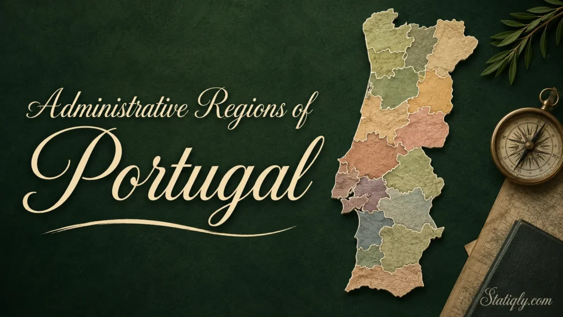
Portugal may look small on a map, but its administrative structure has several layers. Some are used for government, some for statistics, and some still appear in everyday speech even when they no longer work as strong local government units. The simple way to understand it is this: Portugal has two autonomous island regions, hundreds of municipalities, and thousands of civil parishes. On the mainland, people also use statistical regions, districts, metropolitan areas, and intermunicipal communities to describe place, planning, and public services.
This article explains the administrative regions of Portugal in clear English, without turning the map into a maze. A region name on a document, a travel plan, or a data table may not always mean the same thing. In Portugal, that detail matters.
The Simple Way to Read Portugal’s Territorial System
Portugal is a unitary country, so the national state remains the main authority. Yet local life is organized through smaller territorial units. The two island groups, Azores and Madeira, have a special autonomous status. Mainland Portugal uses local authorities and planning areas rather than full mainland regional governments.
| Layer | Portuguese Term | Where It Applies | Main Use |
|---|---|---|---|
| Autonomous Regions | Regiões Autónomas | Azores and Madeira | Regional self-government for the two Atlantic archipelagos |
| Municipalities | Municípios or Concelhos | All of Portugal | Local services, planning, permits, community facilities, and local administration |
| Civil Parishes | Freguesias | Most municipalities | Neighborhood-level or village-level local administration |
| Statistical Regions | NUTS Regions | All of Portugal | Statistics, maps, regional planning, and European comparison |
| Districts | Distritos | Mainland Portugal | Older territorial reference still used in many names and records |
| Intermunicipal Entities | Áreas Metropolitanas and Comunidades Intermunicipais | Mainland Portugal | Coordination between neighboring municipalities |
Autonomous Regions: Azores and Madeira
Portugal has two autonomous regions: the Autonomous Region of the Azores and the Autonomous Region of Madeira. Both sit in the Atlantic Ocean, away from mainland Portugal. Their island geography shaped their special status.
Each autonomous region has its own regional government and legislative assembly. This does not make them separate countries. They are part of Portugal, but they manage many regional matters closer to local needs. Island transport, regional planning, culture, tourism, and some public services often need a different rhythm from the mainland. The system reflects that.
| Autonomous Region | Main Island Group | What Makes It Different |
|---|---|---|
| Azores | Nine main islands in the North Atlantic | A wide ocean territory with island-by-island local identities |
| Madeira | Madeira, Porto Santo, and nearby islands | A compact Atlantic region with its own regional institutions |
For visitors, the autonomous status is easy to notice in small ways. Official websites, public offices, transport information, and local rules may be organized through the regional government rather than a mainland office. For residents, it matters even more.
Mainland Portugal and Its Regional Names
Mainland Portugal does not have autonomous regions like Azores and Madeira. Instead, the mainland is often described through NUTS statistical regions. These regions help organize data, planning, and regional comparison. They are useful, but they are not the same as fully elected regional governments.
This is where many readers get stuck. A map may show “Norte” or “Alentejo” and call it a region. That is correct in a statistical or planning sense. It does not mean that Norte works like Madeira or the Azores. Same word, different role.
Portugal’s NUTS II Regions Used From 2024
| NUTS II Region | Broad Position | Useful Way to Understand It |
|---|---|---|
| Norte | North | Includes Porto and many northern inland and coastal areas |
| Centro | Central Portugal | Covers a large inland and coastal central area |
| Oeste e Vale do Tejo | West and Tagus Valley | Groups areas such as Oeste, Médio Tejo, and Lezíria do Tejo |
| Grande Lisboa | Lisbon area | Covers the core Lisbon metropolitan area |
| Península de Setúbal | South of Lisbon | Covers the Setúbal peninsula area |
| Alentejo | South-central mainland | Known for wide landscapes, towns, agriculture, and inland routes |
| Algarve | Far south | Portugal’s southern coastal region |
| Região Autónoma dos Açores | Atlantic islands | Autonomous island region and NUTS region |
| Região Autónoma da Madeira | Atlantic islands | Autonomous island region and NUTS region |
For research, the NUTS system is handy because it lets people compare regions in a tidy way. For daily life, people usually pay more attention to the municipality and the civil parish.
Municipalities: The Layer People Meet Most Often
The municipality is one of the most useful local units in Portugal. In Portuguese, it may be called a município or concelho. Portugal has 308 municipalities, spread across the mainland and the two autonomous regions.

A municipality is often named after its main town or city, but it usually covers more than that urban center. Think of it like a local area with one main administrative seat and several surrounding places. Not always, but often.
- Lisbon is both a city and a municipality.
- Porto is both a city and a municipality.
- Many smaller municipalities include villages, rural areas, and several civil parishes.
- Some famous place names refer to a town, a municipality, or both, depending on context.
Municipalities matter for local planning, roads, public spaces, libraries, cultural facilities, local taxes, business licensing, and many daily services. When someone asks where a property, school, office, or attraction is located, the municipality often gives the most practical answer.
Civil Parishes: The Small Local Layer
Below municipalities, Portugal has civil parishes, called freguesias. A freguesia may cover a village, part of a city, a small rural area, or a group of nearby settlements. In dense cities, a parish can feel like a neighborhood. In rural areas, it may feel more like a local community.
This layer is small, but not minor. Civil parishes often handle close-to-home matters and local support. Their offices may help residents with certificates, local notices, community spaces, and basic local administration. Quiet work, but useful work.
The number and boundaries of civil parishes can change after official updates. For exact legal boundaries, the safest reference is the latest official administrative map of Portugal, known as CAOP. That matters if someone is checking property, public administration, formal addresses, or local jurisdiction.
Districts: Familiar Names, Limited Local Power
Mainland Portugal also has 18 districts. You may see district names such as Lisbon, Porto, Faro, Braga, Coimbra, Évora, and Santarém. These names are still common in maps, records, addresses, and everyday speech.
Districts can be helpful for orientation. They are not the best way to understand current local government. Portugal’s mainland districts no longer work as strong self-governing regional authorities. When practical questions come up, the municipality usually matters more.
- Use districts for broad location and older references.
- Use municipalities for local administration and services.
- Use civil parishes for the nearest local layer.
- Use NUTS regions for statistics and regional comparison.
Intermunicipal Entities on the Mainland
Some public tasks do not fit neatly inside one municipality. Transport planning, regional roads, economic development, environmental planning, and shared services may involve several neighboring municipalities. For that reason, mainland Portugal uses intermunicipal entities.
Two of the most visible types are metropolitan areas and intermunicipal communities. The best-known metropolitan areas are linked to Lisbon and Porto. These areas help coordinate issues that spill across municipal borders. A bus route does not stop being useful just because it crosses a line on a map.
How Portugal’s Regional Names Feel in Real Life
Portugal’s territorial names are not only administrative labels. They also carry cultural and geographic meaning. A person may say they are from the Algarve, Minho, Alentejo, Trás-os-Montes, or Beiras. Some of these names match current statistical or administrative units. Others are older regional names that people still use because they feel natural.
This is normal. Countries often keep old place names alive long after official maps change. Portugal is no exception. The trick is to ask one plain question: Is this name being used for identity, travel, statistics, or government?
| If You See This | It Usually Means | Best Use |
|---|---|---|
| Algarve | A current southern region | Travel, statistics, planning, and general location |
| Alentejo | A large southern mainland region | Regional identity, maps, statistics, and travel |
| Norte | A current northern statistical region | Statistics, planning, and broad geography |
| Lisboa | Can mean city, municipality, district, or wider area | Check context before assuming the exact meaning |
| Porto | Can mean city, municipality, district, or metropolitan area | Useful, but context matters |
| Freguesia | Civil parish | Local offices, neighborhoods, and small-area administration |
A Clear Method for Reading a Portugal Map
When a map of Portugal shows many labels, start from the largest unit and move down. This keeps things simple.
- First, ask whether the place is on mainland Portugal, in the Azores, or in Madeira.
- Next, identify the broad region, such as Norte, Centro, Alentejo, or Algarve.
- Then check the municipality, because this is often the most useful local government layer.
- For finer detail, look for the civil parish.
- If the document uses a district name, treat it as a broad reference unless the context says otherwise.
This method works well for travel planning, address research, local history, property browsing, and basic geography study. It also avoids a common mistake: treating every “region” as the same type of unit.
Useful Examples by Situation
For Travel Planning
Use broad regions first. If you want beaches in the south, Algarve is the easy reference. If you want wine routes and northern cities, Norte helps. If you want wide countryside, historic towns, and quiet inland routes, Alentejo is a useful name to know. After that, check the municipality for exact locations.
For Addresses
Look for the municipality and civil parish. A district name may appear, but the local layer usually gives better detail. In cities, the civil parish can narrow the place down to a neighborhood-level area.
For Data and Comparisons
Use NUTS regions. They are designed for statistics, so they help compare population, economy, education, housing, and other regional data. For Portugal, the NUTS system is especially common in European datasets.
For Local Services
Start with the municipality. Municipal websites and offices are often the most practical source for local matters. For very local questions, the civil parish may be the right place to check next.
Main Terms Worth Knowing
| Portuguese Term | English Meaning | Plain Explanation |
|---|---|---|
| Região Autónoma | Autonomous region | A self-governing island region within Portugal |
| Município | Municipality | A local government area |
| Concelho | Municipality | Often used in everyday Portuguese for the municipal area |
| Freguesia | Civil parish | The small local administrative unit below the municipality |
| Distrito | District | An older mainland territorial reference still widely recognized |
| Área Metropolitana | Metropolitan area | A group of municipalities around a major urban area |
| Comunidade Intermunicipal | Intermunicipal community | A cooperation area formed by neighboring municipalities |
| NUTS | Statistical territorial units | A European system used for regional statistics and comparison |
| CAOP | Official Administrative Map of Portugal | The official reference for administrative boundaries |
What to Remember When Names Overlap
Portugal’s administrative geography is easier once you separate government, statistics, and local identity. The Azores and Madeira are autonomous regions. Mainland regions such as Norte, Centro, Alentejo, and Algarve are often used for statistics and broad location. Municipalities handle many local matters. Civil parishes bring the map closer to the street, village, or neighborhood.
One country, several layers. Not messy once you know which layer you are looking at.
- For exact official boundaries, check the latest CAOP release.
- For regional statistics, use the current NUTS classification.
- For local services, start with the municipality.
- For small-area identity and local offices, check the civil parish.
- For island governance, treat Azores and Madeira as autonomous regions within Portugal.